Deprecated: Function WP_Dependencies->add_data() was called with an argument that is deprecated since version 6.9.0! IE conditional comments are ignored by all supported browsers. in /home/kbashaar/kathrynbashaar.com/wp-includes/functions.php on line 6131
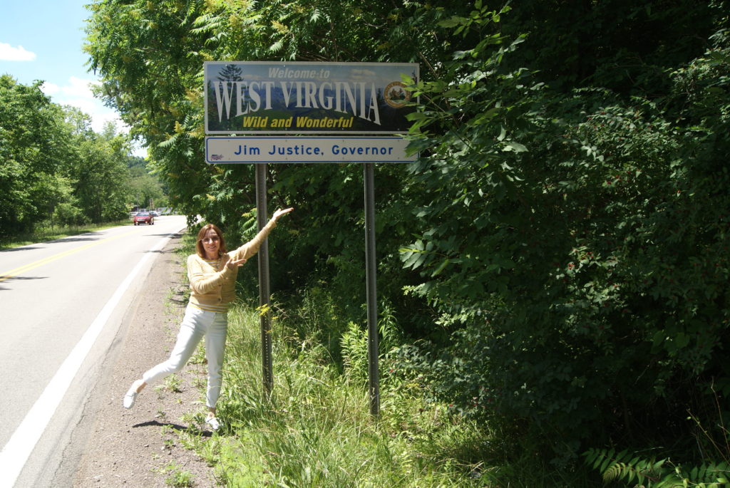
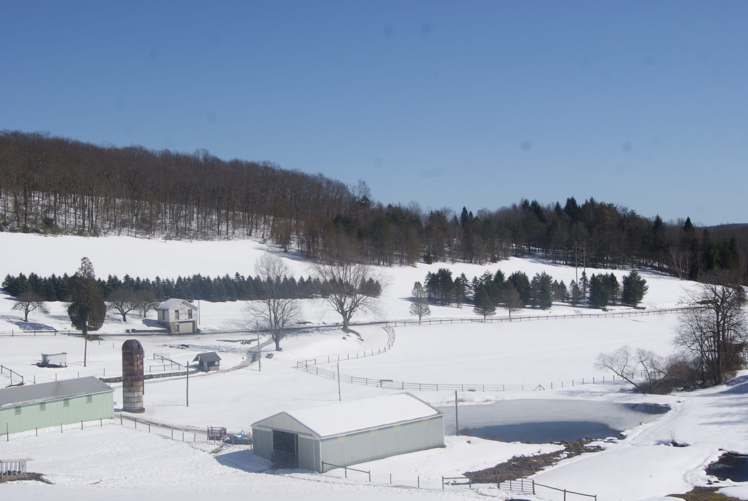
We have now driven the whole National Road in Pennsylvania!
I love people who are passionate and knowledgeable about something, whether it is clocks or old books or astronomy. I especially love people who are passionately interested in and knowledgeable about their own communities. In our travels along the National Road over the past few months, Al and I have met several people like that. And we met one on our most recent drive.
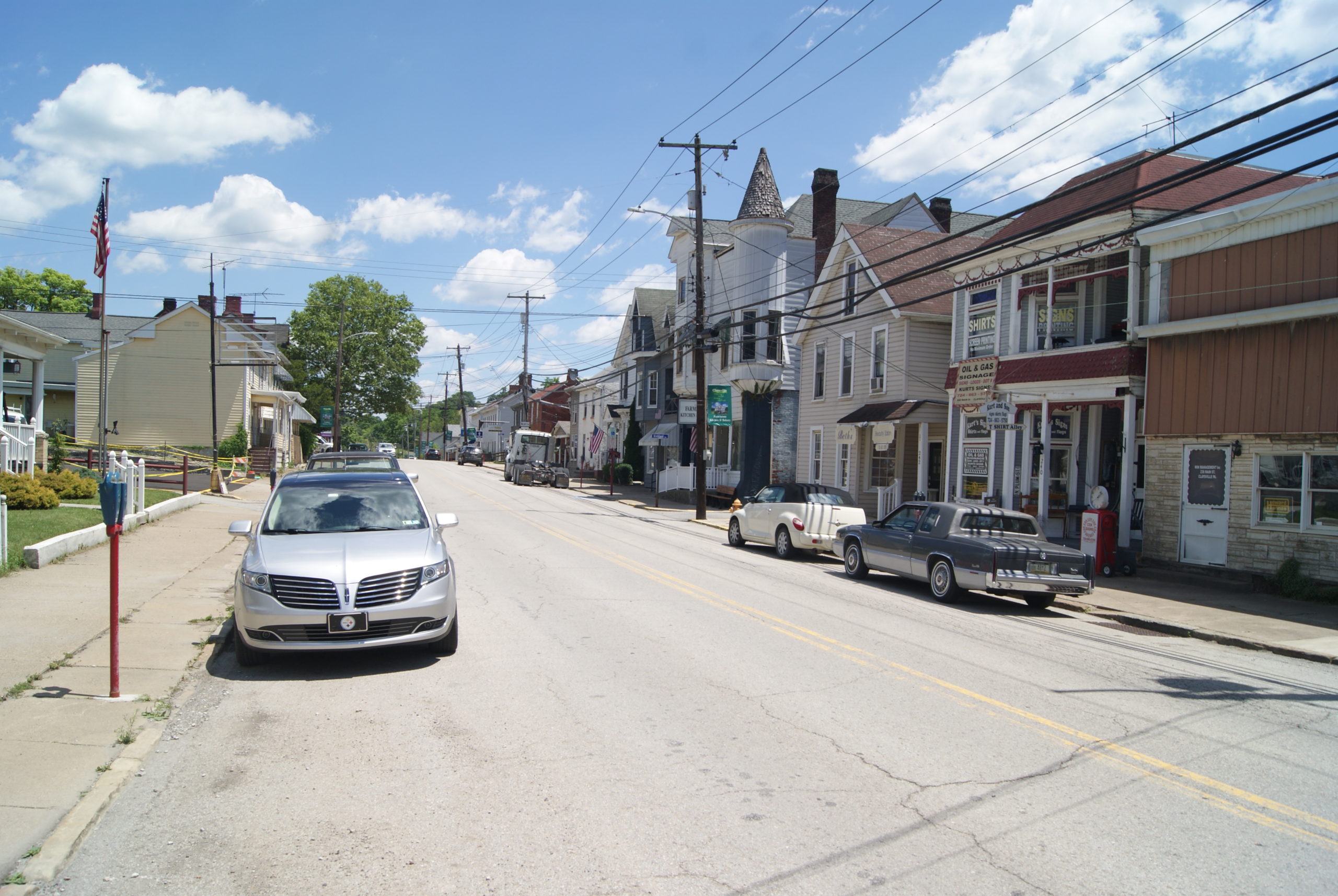
This week we made our last stops on the National Road in Pennsylvania, stopping at the S Bridge, passing through Claysville, and visiting West Alexander.
First, Lunch
We stopped in Washington, PA, on our way to this week’s destinations, and had lunch at Chicco Baccelo. We enjoyed our lunch there when we were in town last summer vising the David Bradford House. Once again, it did not disappoint. My Hannah wrap, iced chai latte and chocolate chip cookie, and Al’s Brenda Lou sandwich, hot chocolate and molasses cookie were delicious.
Some other places we enjoy in Washington:
The Union Grill. Cool speakeasy vibe and the BEST house-made chips!
Liberty Pole Spirits. Their distillery tour is so much fun that we’ve now taken it twice. This family-owned business is so very passionate about making whiskey.
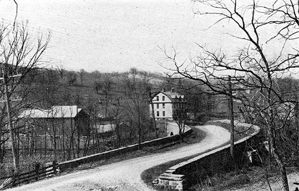
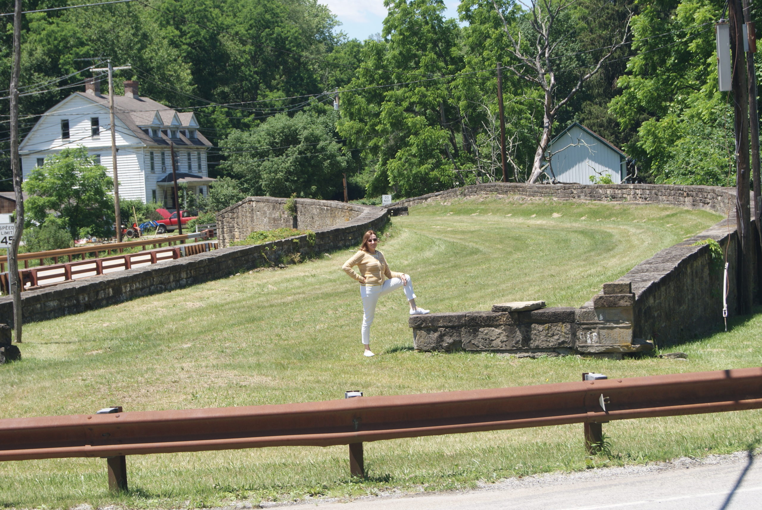
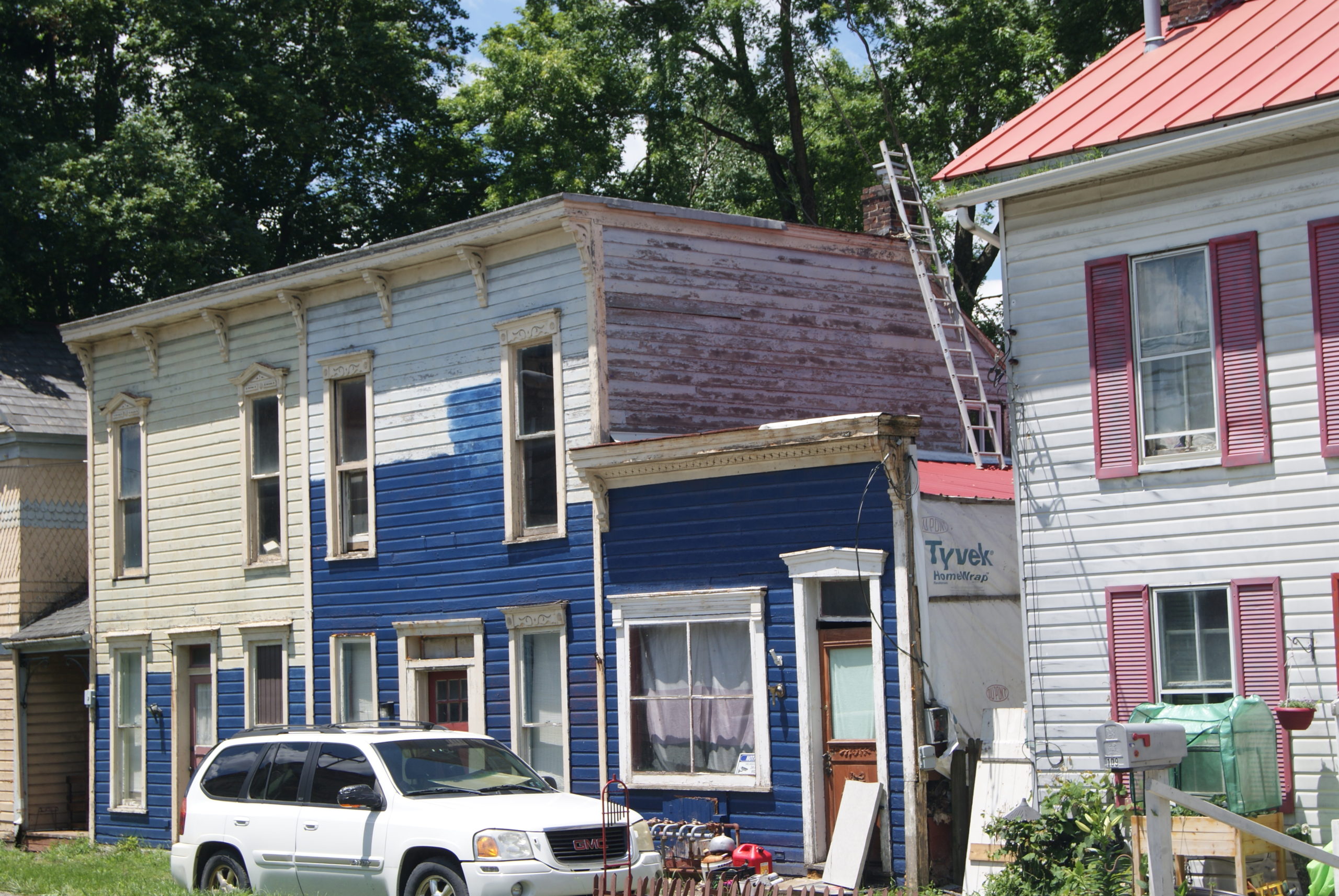
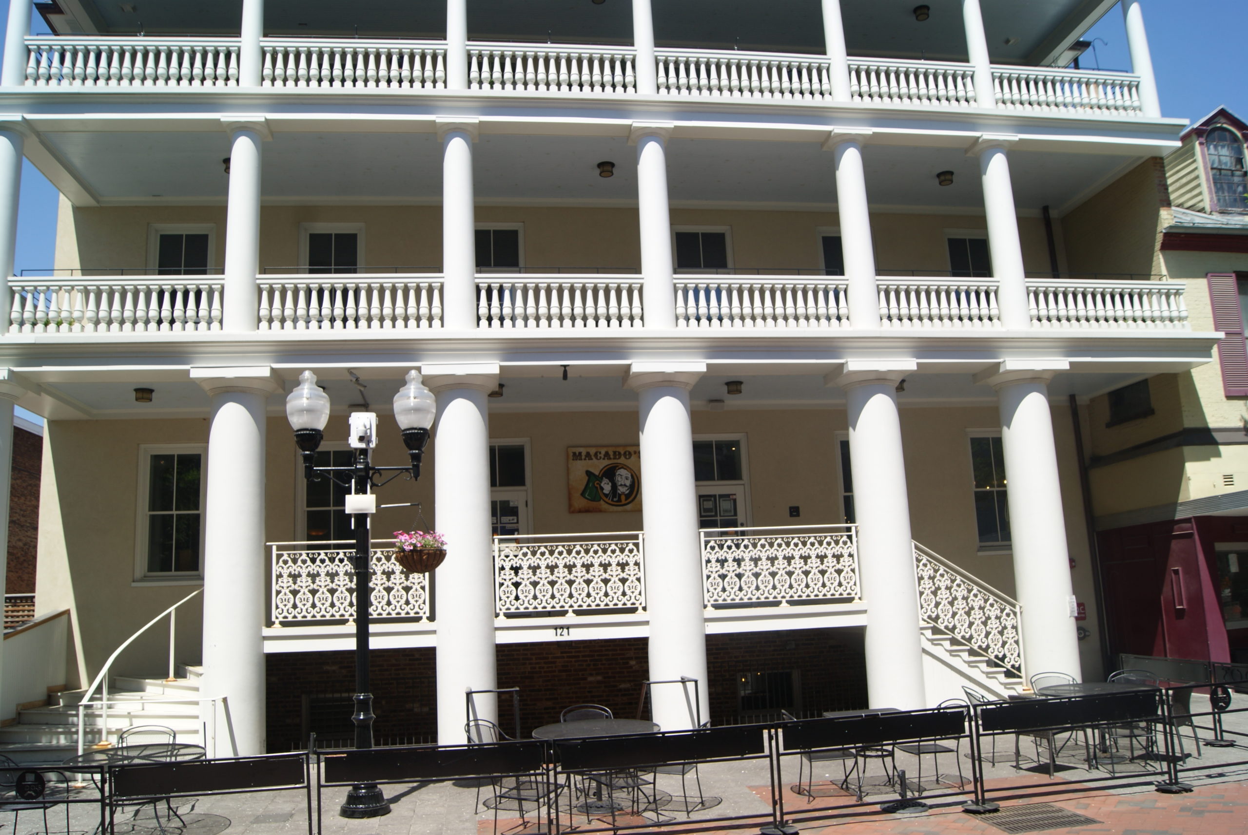
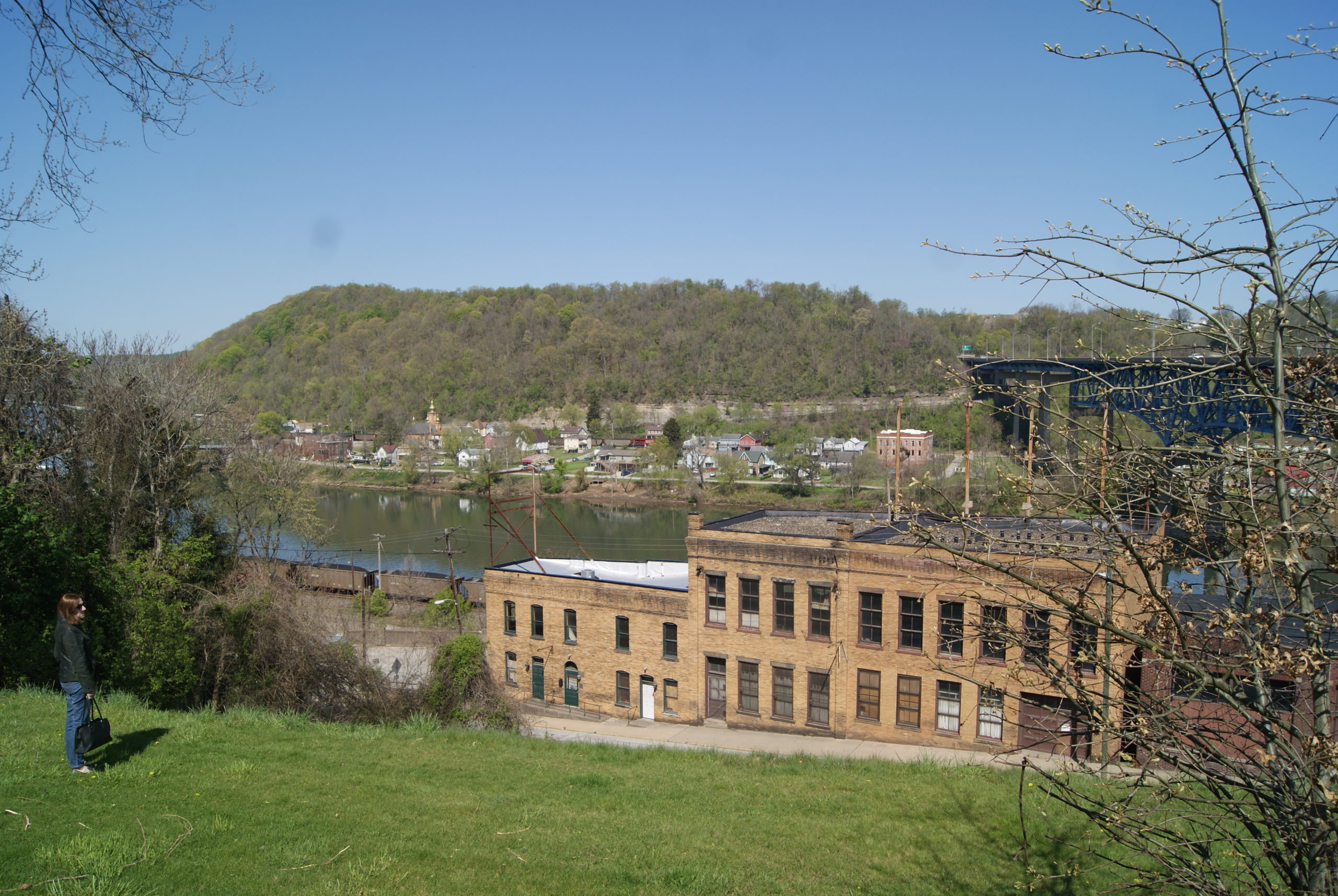
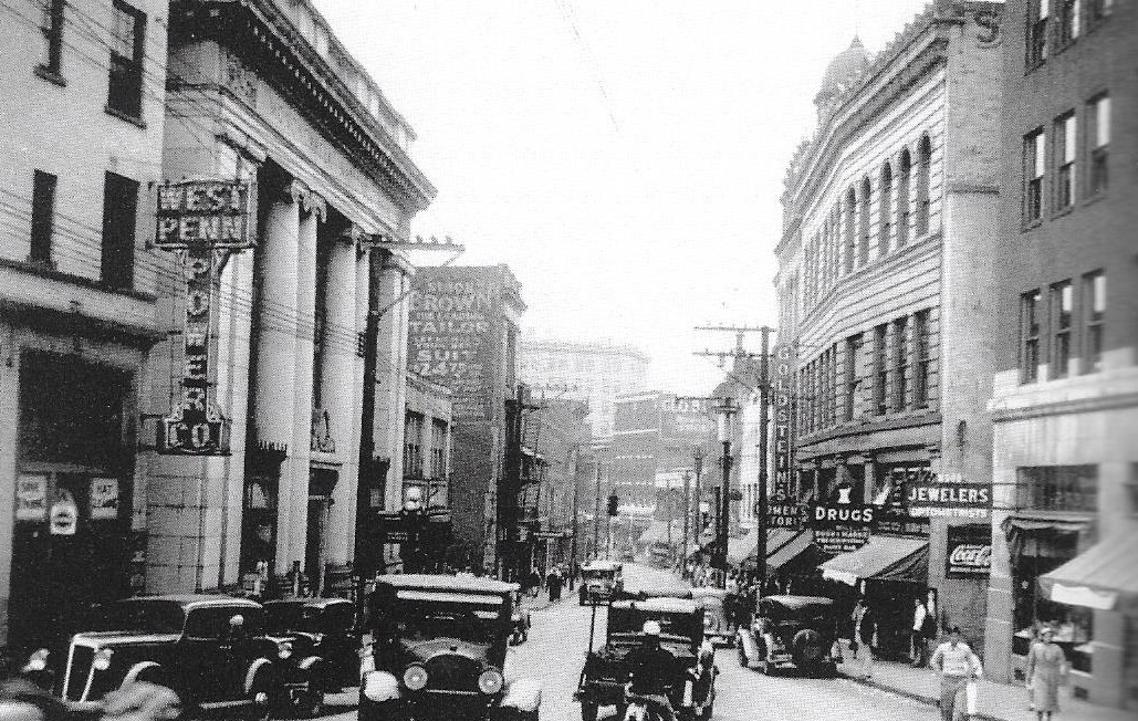
The S Bridge
The S Bridge in 1910 and today. Note that the white building in the first picture still stands.
I had never heard of an S Bridge before, but it was a pretty common construction in the early nineteenth century. Builders usually used the S-bridge approach for a crossing small, curving stream with uneven banks, when the bridge had to cross the stream at an angle. The S is formed by constructing the bridge at 90% angle to the stream, with aprons on either bank, forming a letter S.
The 1815 S Bridge over Buffalo Creek, just outside Claysville, has been almost completely restored. The young man we met later in West Alexander told us about Gerald David McKenzie. McKenzie almost single-handedly saved this bridge. For years, he sat along the road near the bridge with an American flag, telling the story of the bridge to anyone who would stop and listen. Watch this YouTube video to hear an interview with McKenzie from 1994, and see the deterioration of the bridge at that time. Thanks to McKenzie’s efforts, the bridge was restored, through a combination of private donations and state funding.
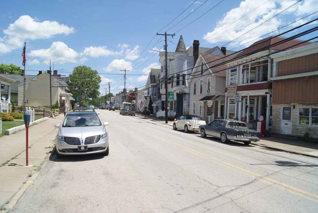
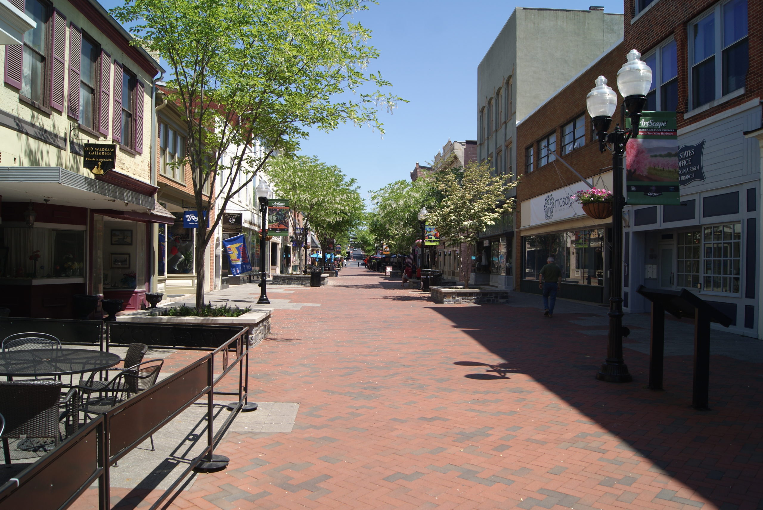
Claysville
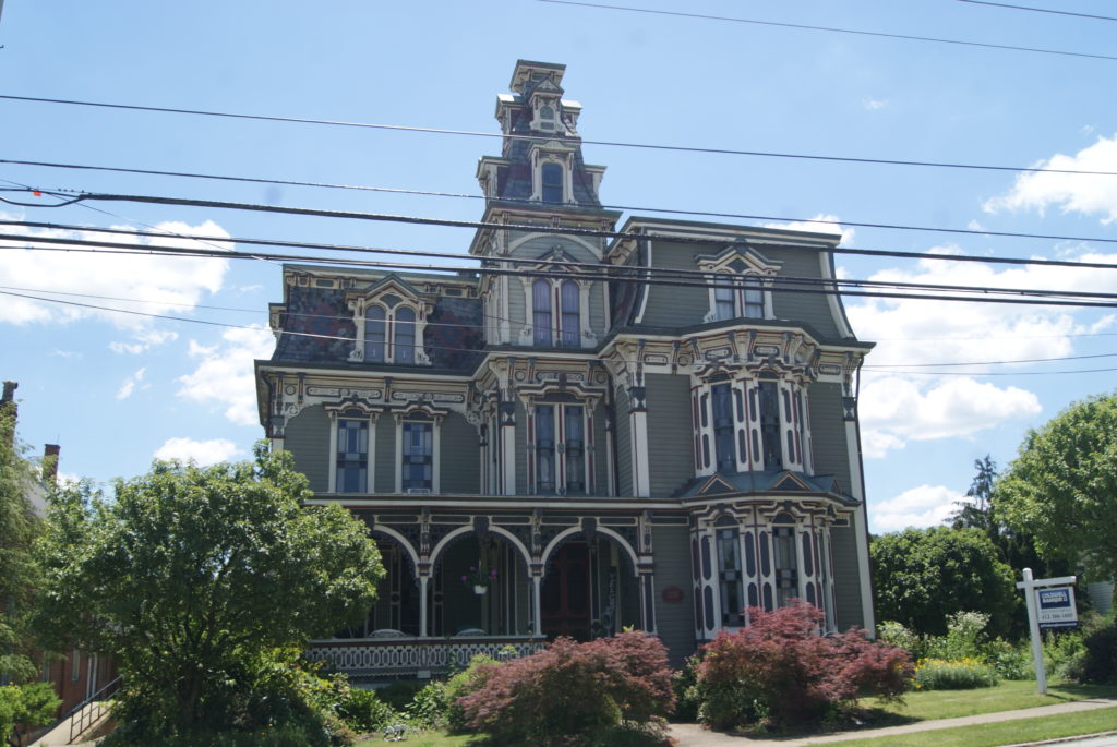
National Road in Claysville today
How about this beauty? And it’s for sale!
John Purviance, one of Claysville’s earliest farmers, also opened a tavern nearby as early as 1800. When he learned in 1817 that the planned National Road would cross his land, he saw opportunity. Purviance plotted out a town along the planned route of the road, and named it Claysville after U.S. Senator Henry Clay. Clay had been a strong proponent of public works like the National Road.
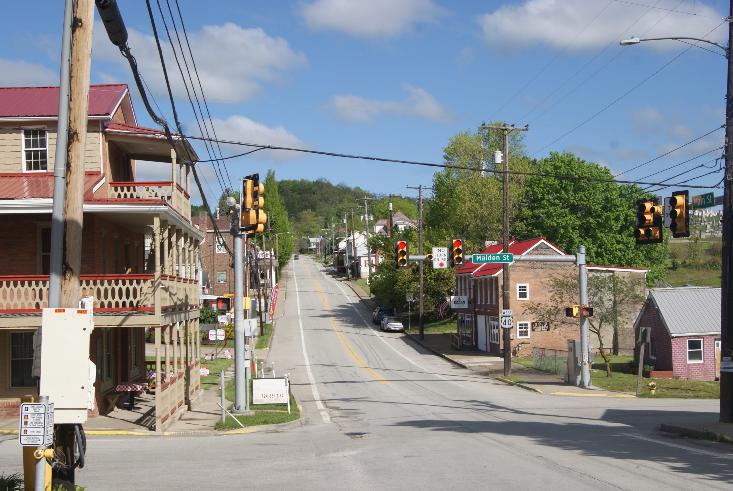
Like so many other towns along the National Road, Claysville thrived after the road came through in 1820. In the nineteenth century, the town was a regional agricultural service center. It was also home to businesses serving the oil and gas industry, and many other small businesses. The town has diminished since then, but it isn’t in the decrepit state of some other towns that we’ve seen in our travels. It’s a pleasant, small community that seems to be holding its own. Its Main Street still strings along the route of the old National Road, near Routes 40 and 70.
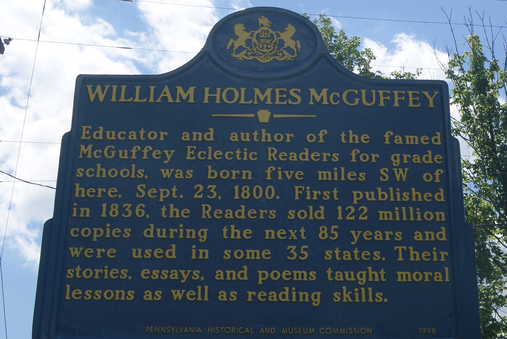
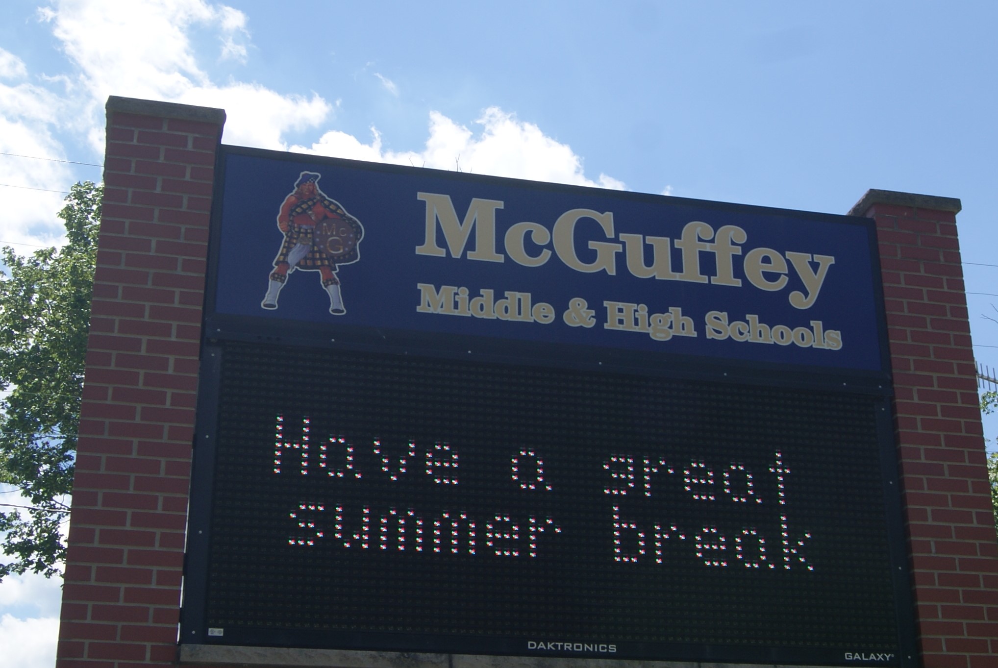
Claysville’s most famous native son is probably William Holmes McGuffy, who was born near Claysville in 1800. He authored the McGuffy Reader series, which was used almost universally in American schools in the nineteenth century. The local school district is named for him.
Pennsylvania’s Gretna Green
As so often happens to us when we explore small towns, on our last stop we met a friendly local person with lots of knowledge and enthusiasm.
Future home of a full-service wedding venue.
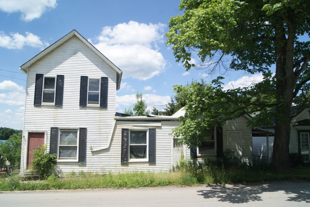
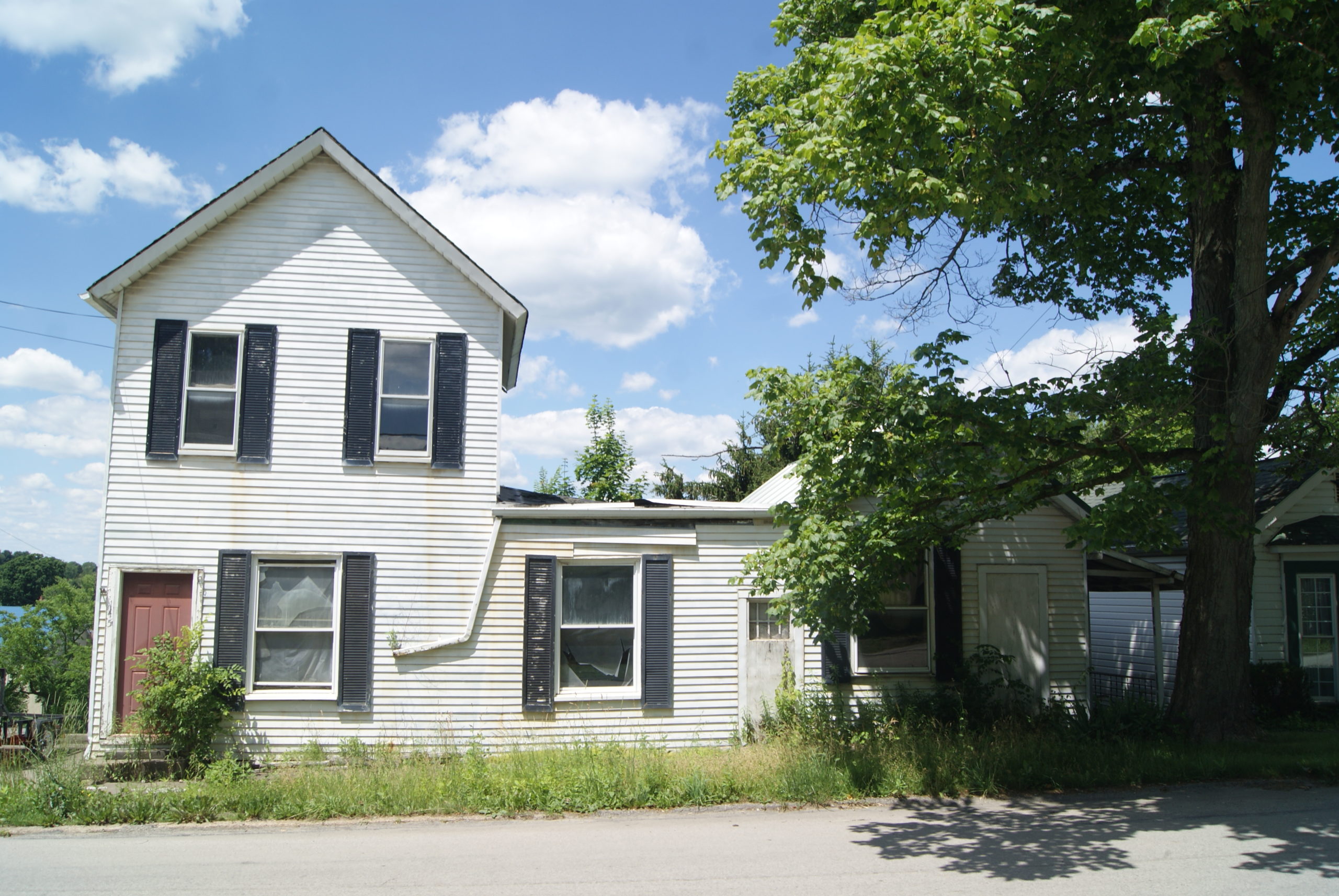
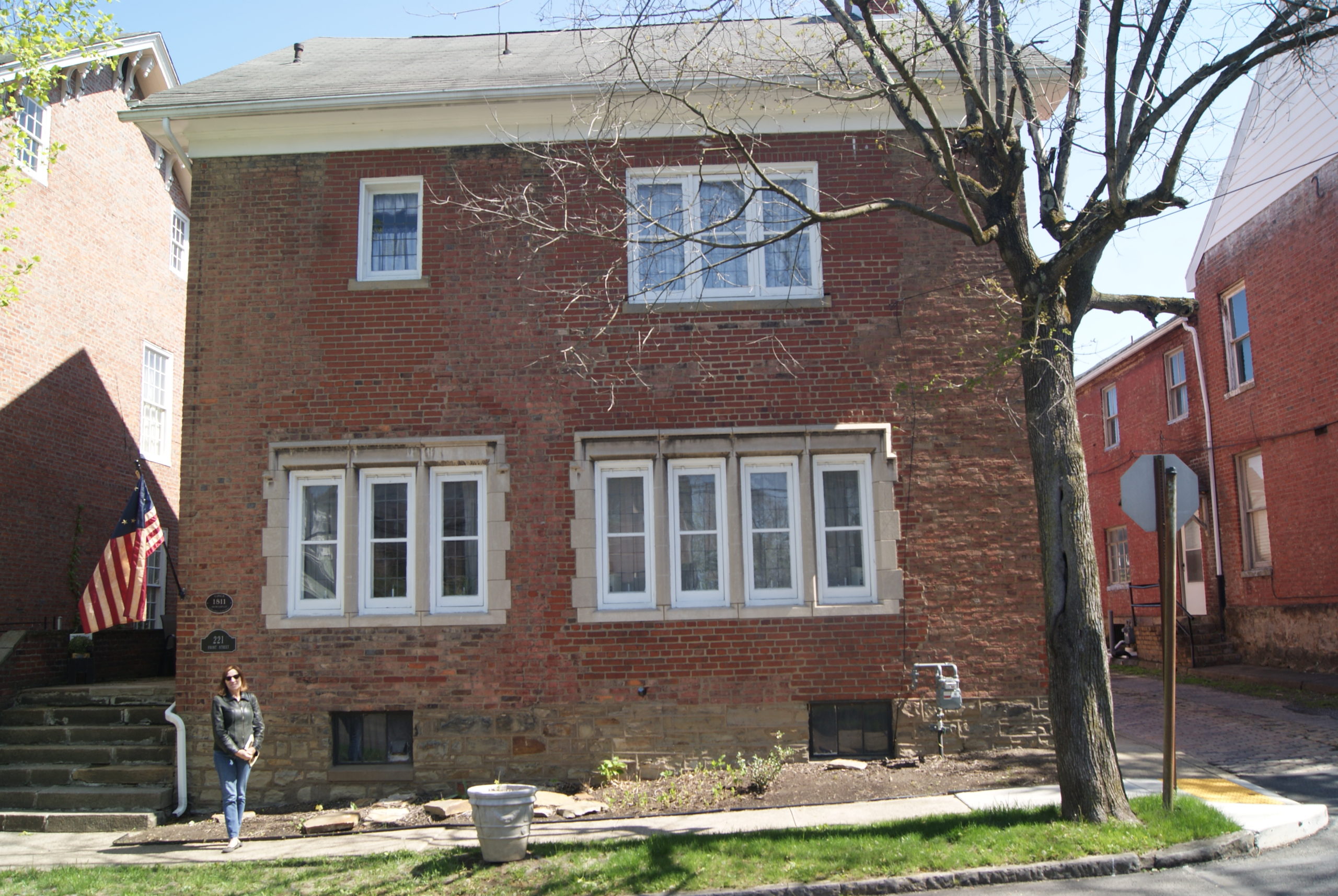
Jeremy Wiley noticed us poking around in the graveyard in West Alexander and pointed us to the location of the oldest graves, and we got to talking to him. He owns the row of old two-story frame houses that used to form the nucleus of West Alexander’s quaint shopping district in the 1970s and 80s.
When I was young, I remember my mom going to West Alexander once or twice a year to shop for antiques and pottery. In the early 90s, part of the block burned in a fire, and the rest of the retro little business district never really recovered. Jeremy is now working towards combining the row of buildings into a wedding venue.
A wedding venue sounds like a pretty good bet for a community that was once known as Pennsylvania’s Gretna Green. Gretna Green is a town in Scotland, right on the border with England. Between 1754 and 1929, English law required parental consent for brides or grooms under the age of 21. Scotland had no such requirement. So, eager young couples often crossed the border to Gretna Green to marry. Similarly, West Alexander stands very close to Pennsylvania’s border with both Ohio and West Virginia. In the nineteenth century, Pennsylvania had no marriage-license laws at all, and West Alexander became a popular elopement destination for couples from Ohio and West Virginia, where the laws were stricter.
West Alexander History
Robert Humphrey founded the town of West Alexander in 1792 and named it after his wife, Martha Alexander. Once the National Road came through in 1820, the town boomed, with as many as 25 stagecoach stops daily.
Jeremy’s buildings date to the 1840s, right after West Alexander’s first disastrous fire in 1831. He’s found newspapers in his cellar dating as far back as 1875. He believes that his buildings rest on the foundations of older buildings that were destroyed in the 1831 fire, and that the stone chimneys also predate the fire. Jeremy and his wife have found remnants of the old foundations in his basements, and charcoal that is probably what remains of the old wooden buildings. He also found the old stacked-stone wells in his backyards, and has dug out one of them, to find it filled with discarded bottles. Jeremy is still finding old pottery molds as he cleans out the portion of his property that was the pottery shop. If anyone want pottery molds, he is giving them away for free. Contact him at jeremyhaydenwiley@yahoo.com.
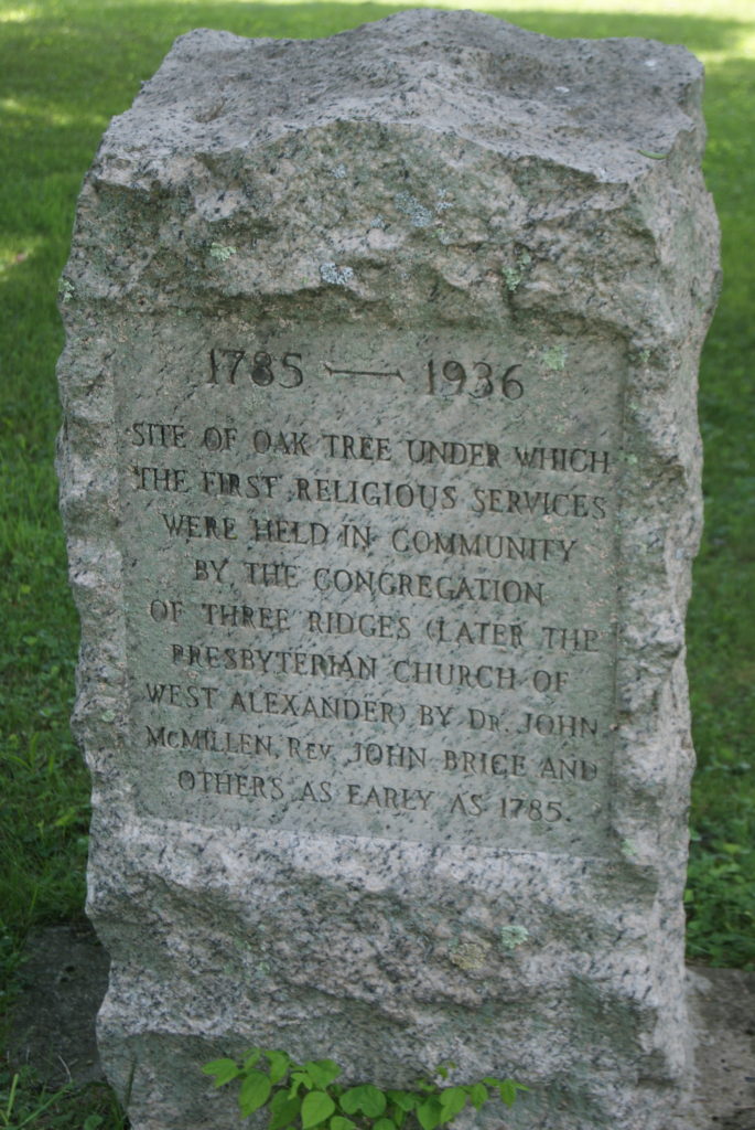
Jeremy also showed us the marker that indicates where the first church service was held outdoors in 1790. It stands in the graveyard, below and to the left of the current church.
West Alexander Architecture
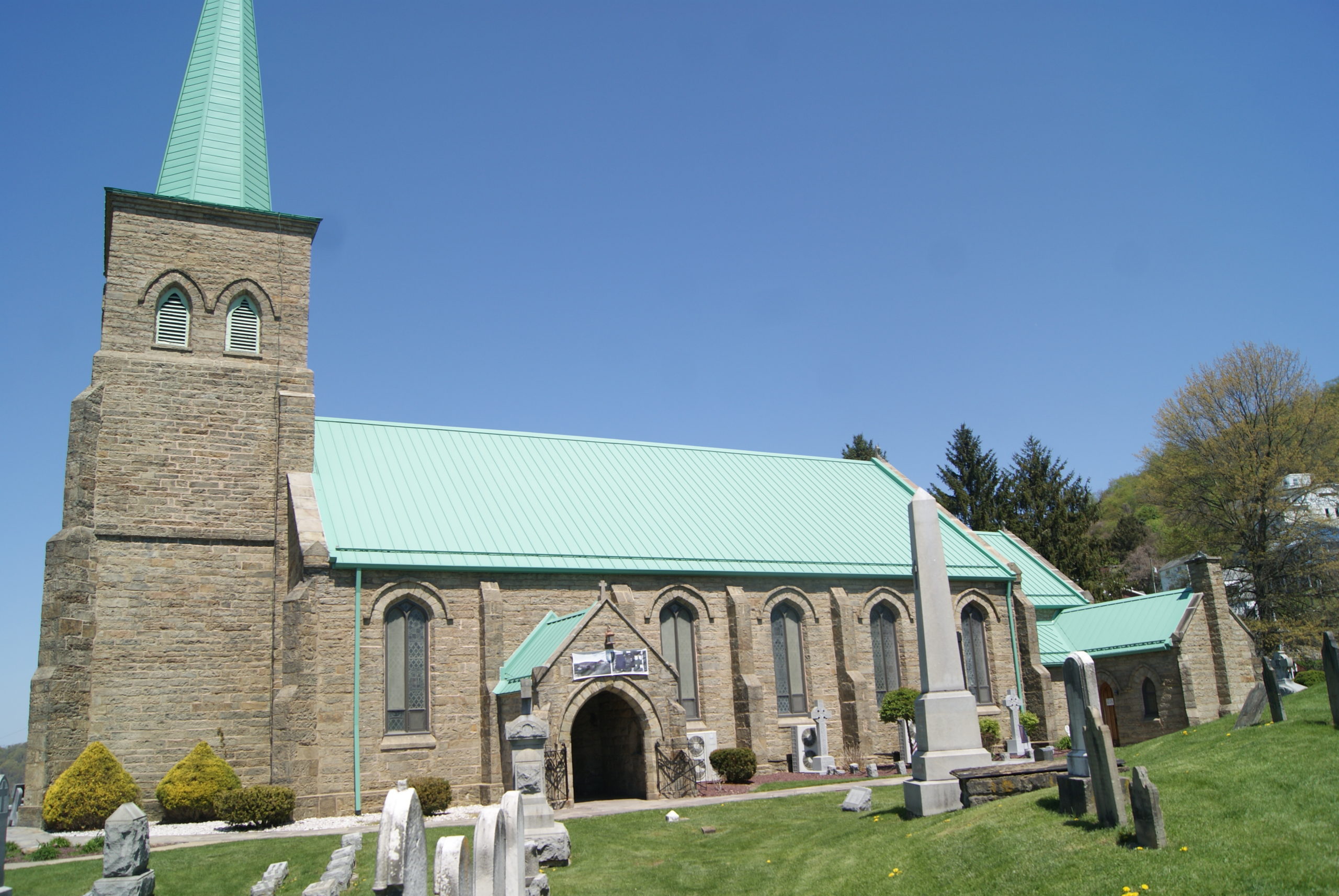
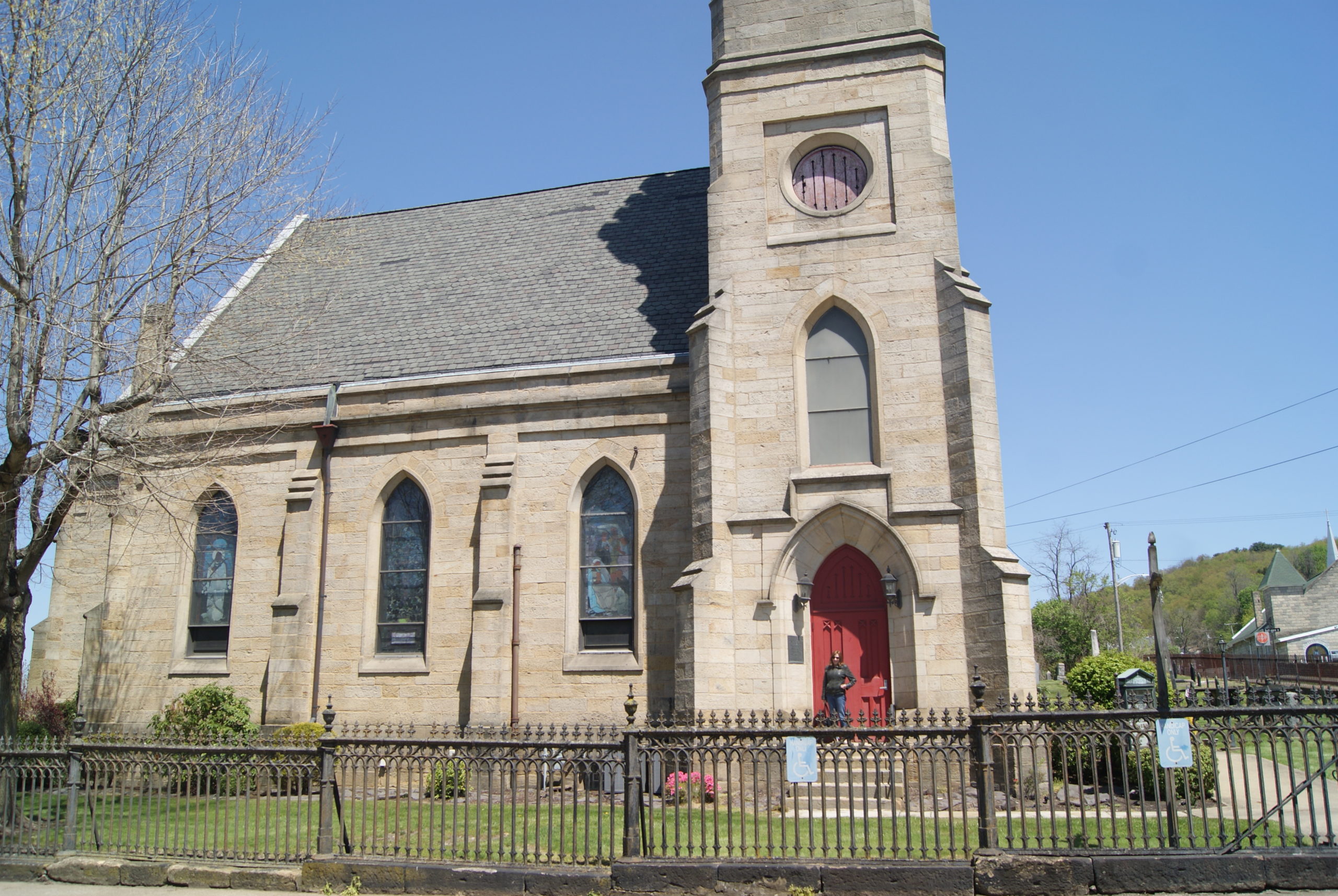
The West Alexander graveyard is lovely and peaceful, right between the town’s two churches. Similar to Beallsville, much of the old architecture in West Alexander is still intact, in spite of at least two major fires.
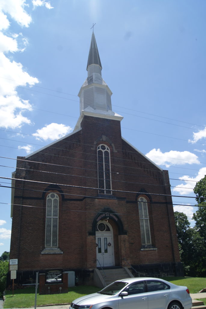
This Greek Revival church dates to 1872
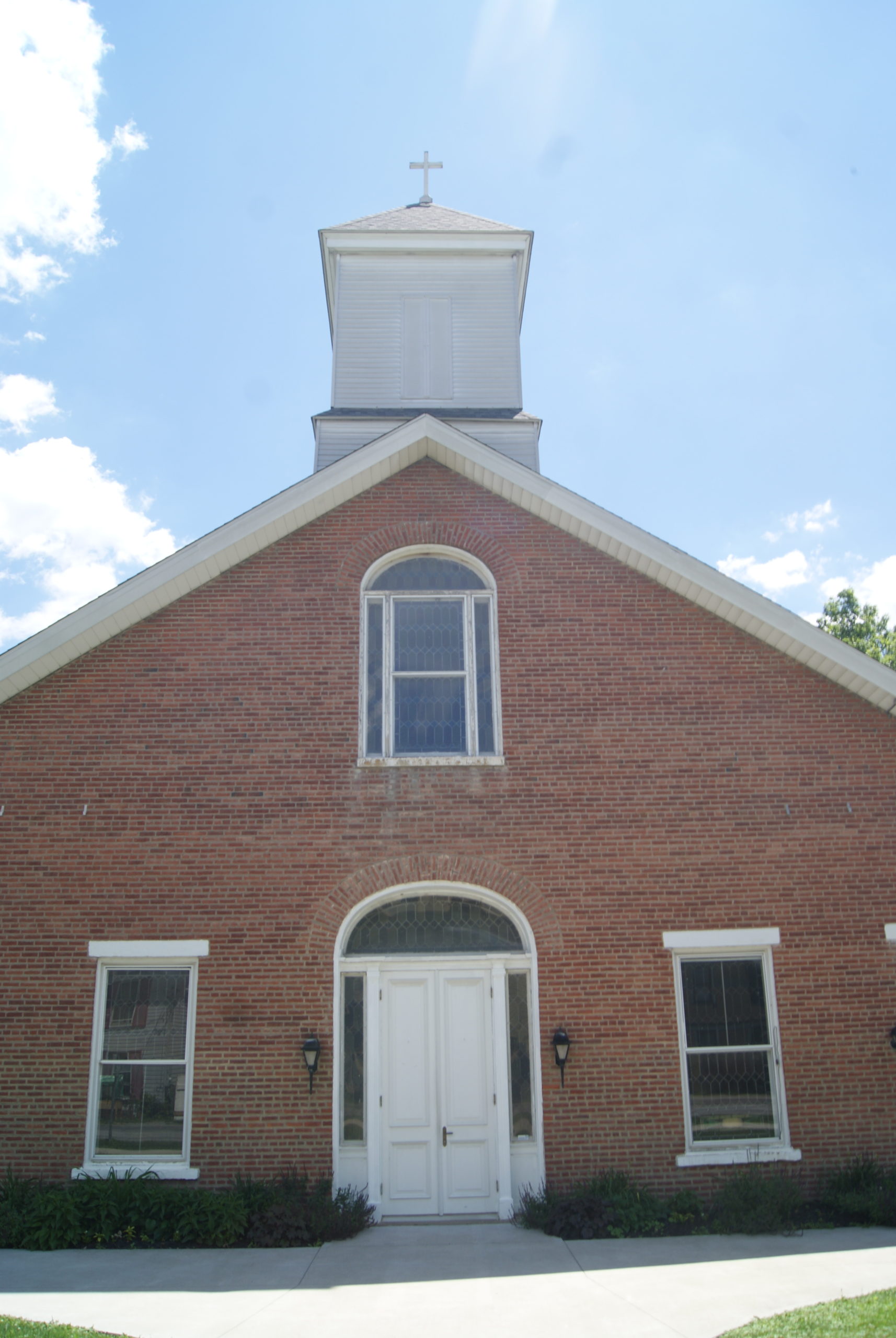
This Romanesque Presbyterian church dates to the 1830s
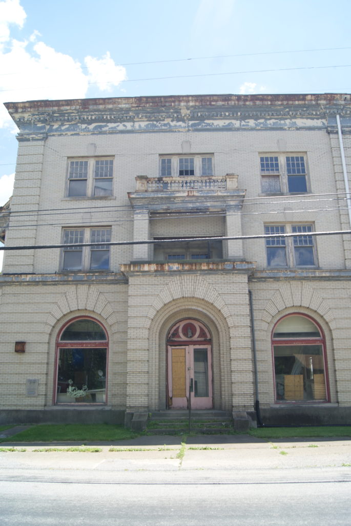
This building once housed the town’s post office and bank, with offices on upper floors, and a theater on the top floor.
Memorial at the site where church services were held before the current Presbyterian church was built.
This beautifully-maintained home was once the manse for the Presbyterian church.
The right-hand one-story section of these attached buildings is believed to be the oldest standing building in town, a survivor of the 1831 fire
West Alexander’s Future
The people of West Alexander are making a strong effort to improve their town. Jeremy is working on his property, a community center recently opened along the main street, and the recreation committee is fund-raising for a community playground. The owner of the old bank building (see above) seeks to renovate the building into condos or apartments, and even hopes to re-open the theater that once graced the top floor. Al and I thoroughly enjoyed our visit to this pretty little community, and plan to stop back and check on its progress.
COMING NEXT: Now that we’ve completed our drive along Pennsylvania’s section of the National Road, it’s on to West Virginia and beyond!
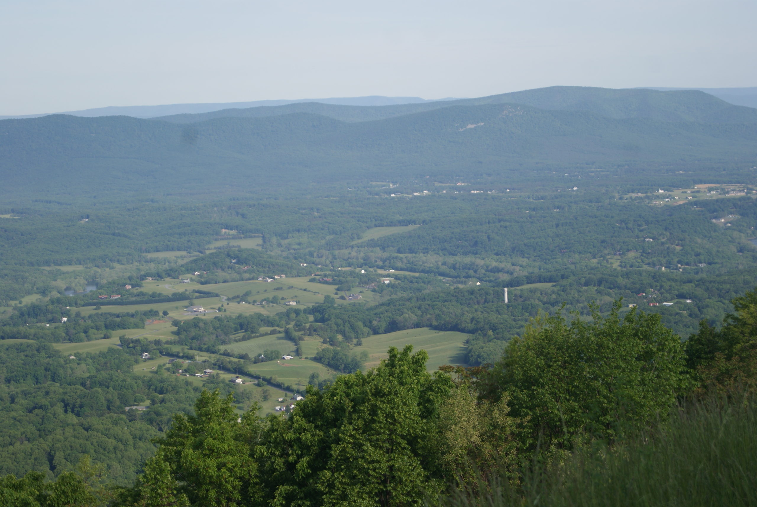
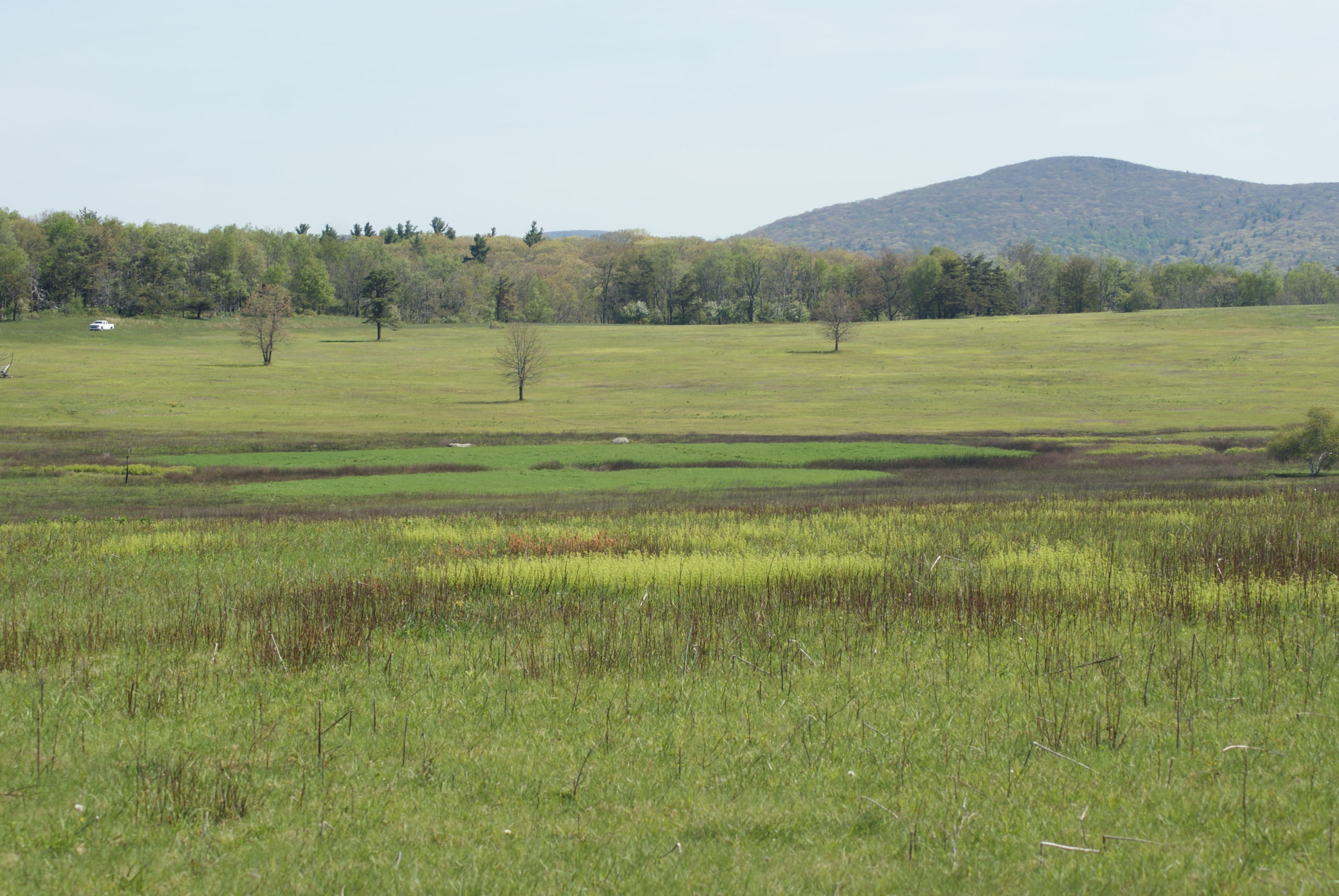
From any of the 75 scenic overlooks along Skyline Drive in Shenandoah National Park, you can view the broad, green expanse of the beautiful Shenandoah Valley. It lies between the Blue Ridge Mountains to the east and the Allegheny Mountains to the west. No more than 25 miles wide at any point, it is peaceful, bucolic and semi-rural. Before the American Civil War, it was Virginia’s breadbasket.
And during the war it was hotly contested.
Encyclopediavirginia.org aptly describes the valley as pointing “dagger-like at the North and especially at Washington, D.C.” And the Union wanted that dagger blunted.
General Thomas “Stonewall” Jackson successfully defended the Valley in 1862. And Robert E Lee used it as the jump-off point for his Gettysburg campaign in 1863, using the mountains to screen his army’s movement.
Prelude to the Battle of Cedar Creek
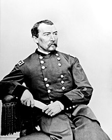
Union General Philip Sheridan
Confederate General Jubal Early
But by 1864, conditions favored the Union. Stonewall Jackson was dead. The Confederates were running out of supplies and the loss of the valley would deprive Lee’s army of a desperately-needed source of grain and livestock. Grant had Lee pinned down near Petersburg. And three years of war had depleted Confederate manpower.
The 1864 Shenandoah Valley campaign was characterized by hubris on both sides. And the Battle of Cedar Creek is particularly interesting because it featured so many surprising twists and turns, all in one day.
In the early summer of 1864, Confederate General Jubal Early conducted raids out of the Shenandoah towards Washington, D.C. He hoped to force Ulysses Grant to divert some of his forces to defend the capital, which would bring some relief to Lee at Petersburg. Instead, Grant decided that it was time to eliminate the pesky Early. He gave the job to General Philip Sheridan, along with orders to pursue Early “to the death.”
Sheridan Surprises Early
Early had some initial success in fending off Union forces and Lee became complacent enough to bring a division back to defend Richmond. So, when Sheridan next attacked, he swept the Rebel army out ofWinchester, forcing them to retreat south through the Shenandoah Valley to Waynesboro.
Presaging Sherman’s March to the Sea in the west, Sheridan executed a scorched-earth campaign through the valley to deprive the Confederate army of desperately-needed food. Following Grant’s order that he make the valley “so desolate that crows flying over it would have to carry their own provender,” Sheridan slaughtered sheep, hogs and cattle, and claimed to have put the torch to 2000 barns and over 70 mills.
But now it was Sheridan’s turn to become over-confident. Convinced that he had sufficiently weakened his opponent, Sheridan sent a whole corps back to Petersburg. He established his headquarters at Cedar Creek, and left for a meeting in Washington.
Sheridan had some reason for complacency. His troops were well-positioned behind Cedar Creek near Belle Grove Plantation, and they outnumbered the Confederate forces. But the Rebels knew the terrain. And General John Gordon took a look from one of the mountaintops and thought he saw a small chance to surprise their opponents.
Early Turns the Tables
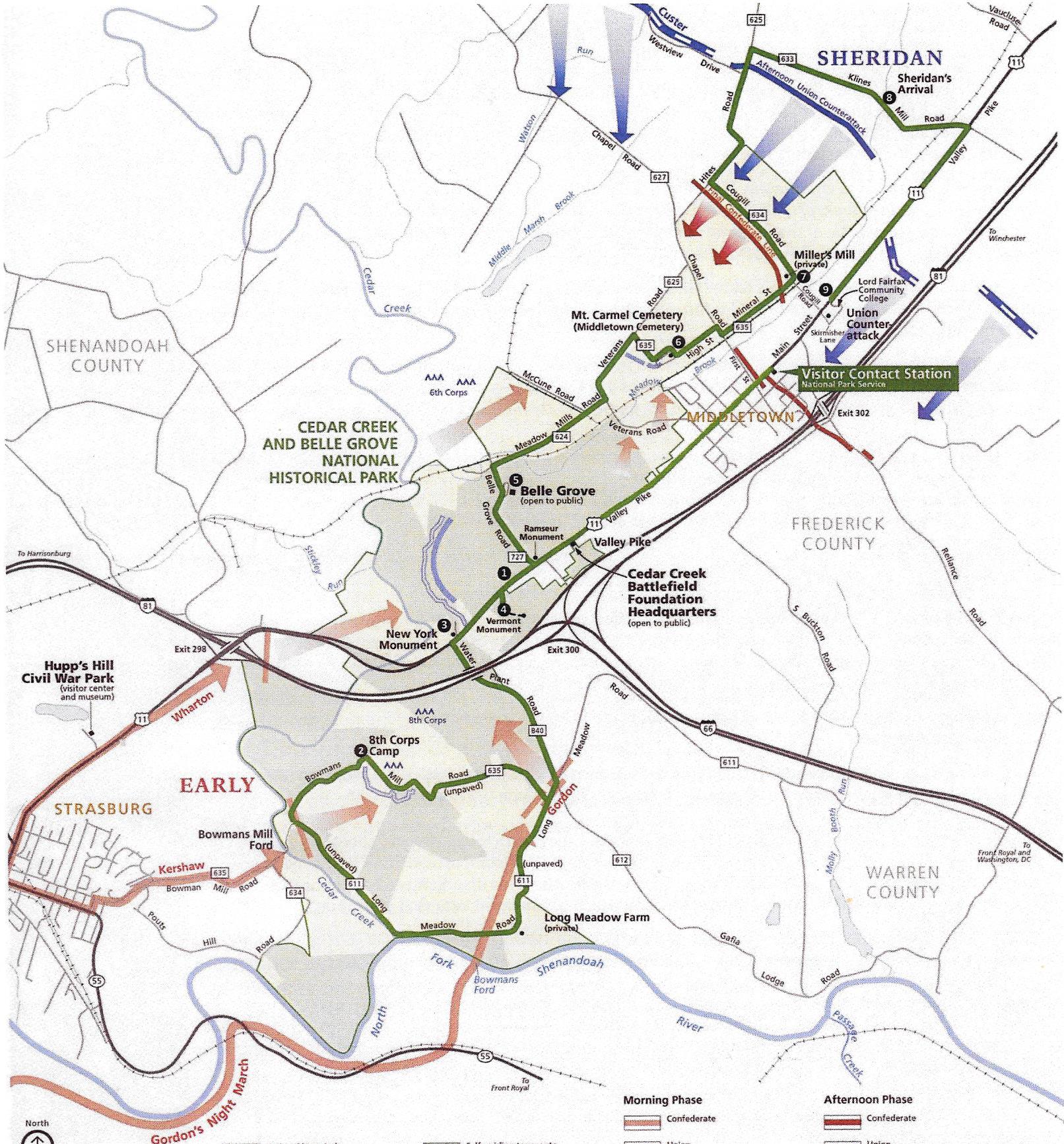
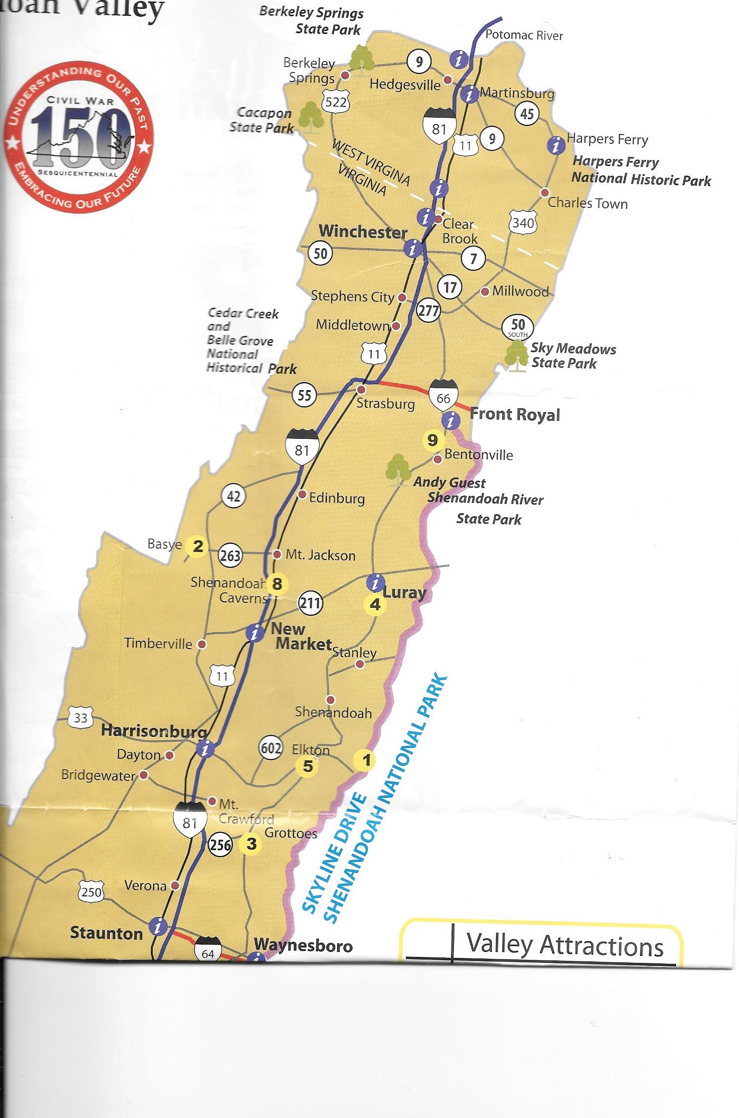
Detail Map of Battlefield
Shenandoah Valley between Winchester and Waynesboro
Here are some maps of the battlefield and the general area
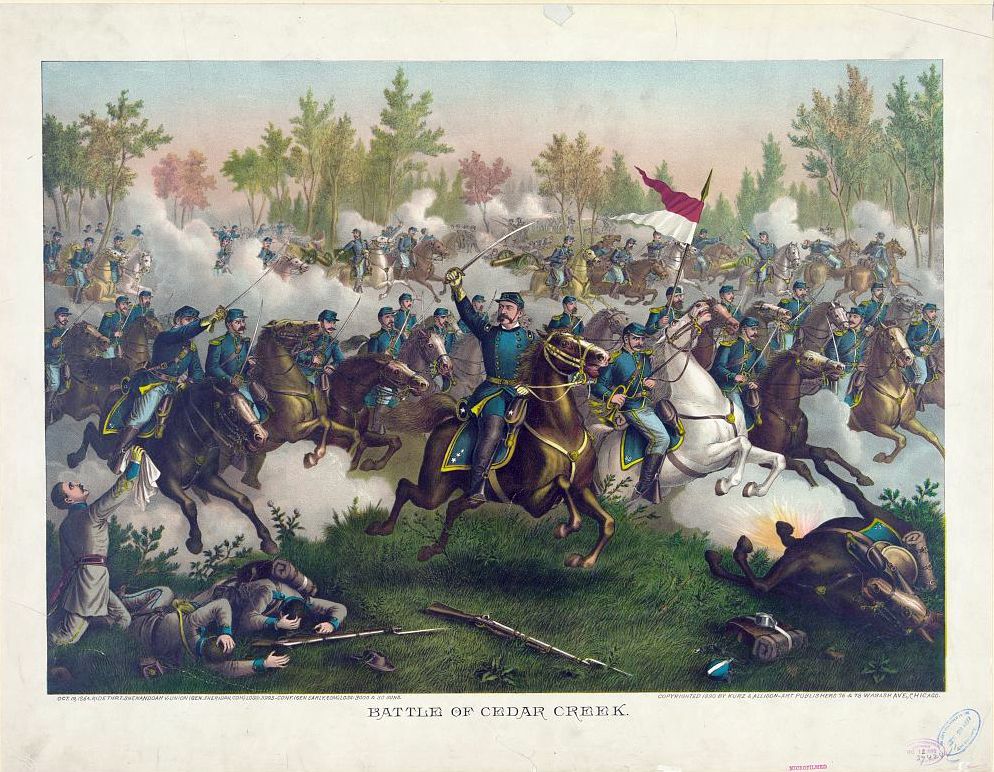
Everything had to work perfectly. Without the benefit of modern communications, three columns of Rebel infantry and two cavalry brigades had to converge on the Union flank at the same time, crossing both Cedar Creek and the Shenandoah River, and travelling by night. Against all odds and aided by heavy fog, the Rebels completely surprised the Union Army of West Virginia, including a division commanded by future president Rutherford B. Hayes. Future business magnate Henry DuPont received a Medal of Honor after the battle, for stalling the Confederate advance with his artillery, and saving nine of his sixteen cannons. But is wasn’t anything close to enough.
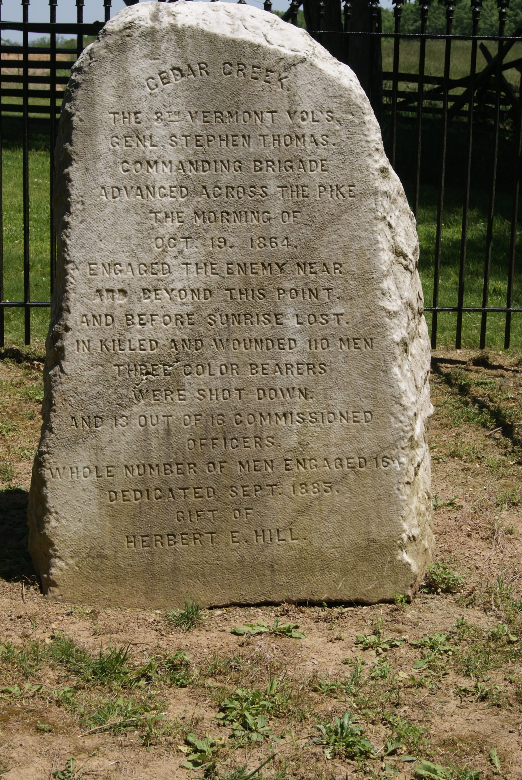
Monument to the 8th Vermont at Cedar Creek Battlefield Park
Union General William Emory ordered a brigade into the fighting to slow down the Rebels. To me, this is the most poignant moment of the battle. A brigade of no more than 1000 men from Vermont, New York, Pennsylvania, and Connecticut is sent towards the battle line to hold off the enemy until a larger force can form a new line. They must have known that they would take heavy casualties. As the Vermonters at the front of the skirmish line moved forward, retreating forces rushed past them in the other direction.
One Vermonter described the moment when they met the Confederates at dawn in the fog-shrouded woods:
“One of the most desperate and ugly hand-to-hand conflicts over the flag that has ever been recorded…Men seemed more like demons than human beings, as they struck fiercely at each other with clubbed musket and bayonet.”
Of the 165 Vermont men who fought, 110 we killed or wounded. The 47th Pennsylvania suffered 40 killed and 134 wounded out of 300 men. But they had bought precious time – and help was on the way.
The Tables Turn Again
Sheridan had spent the night In Winchester on his way home from Washington. He heard reports as early as 6 a.m. of sounds of artillery coming from the south. But he didn’t round up his cavalry and start riding south until 9 a.m. By the time he reached the battlefield around 10:30, the Union had retreated and begun to form a new defensive line.
It was the Confederates’ turn to be complacent again. Early had thoroughly routed his enemy and failed to pursue. The Rebel troops focused on plundering some much-needed supplies. This is another poignant moment. The Rebel soldiers, barefoot and hungry, cold and wet from their march, come across a bounty. Blankets and uniforms. Boots! Food! And 24 captured union artillery pieces. But they weren’t counting on Sheridan. The Union general immediately began organizing a counter-attack and swore that he would make coffee from Cedar Creek by evening.
At 4:00 the Union began their attack. One of the day’s heroes was General George Armstrong Custer, whose cavalry hit the Rebels hard. By 5:00, there was no more Confederate army in the Shenandoah Valley.
Total Union casualties for the day numbered 5665, against 2910 Confederate casualties. But those were men that the South could ill afford to lose. The North would control the Shenandoah Valley for the rest of the war. And Appomattox was only six months in the future.
NOTE: If you want to drive the battlefield, the National Park Service offers a guided tour that can be downloaded to your phoneHERE. Also worth a visit is the Cedar Creek Battlefield Foundation headquarters, located at 8437 Valley Pike in Middletown, VA. They have a very nice selection of art and books about the battle and the Civil War in general, as well as gift items made by local crafters. They were closed for remodeling when we stopped, but they let us in to look around anyway and were very helpful in directing us to the NPS guided tour download.
My own interest in history focuses primarily on Western Pennsylvania. But Al is a lifelong American Civil War buff. So, as a treat to him for our 38th wedding anniversary last week, we visited some Civil War battlefields in Virginia. The trip also gave us a chance to return to Shenandoah National Park. And we celebrated our anniversary with a fabulous dinner at a tapas bar in downtown Front Royal.
First Stop: Winchester, Virginia
I love this sketch of one of the battles in Winchester. It captures the movement and chaos of battle so perfectly.
We arrived at the Shenandoah Valley Civil War Museum just as it opened on a Wednesday morning. The museum lives in an 1840 Greek revival building that once served as the Frederick County Courthouse. One the first floor, the courtroom has been restored to its nineteenth-century austere beauty.
The second floor displays an extensive and well-organized collection of Civil War relics, as well as reproductions of pencil sketches made on-site during the many battles that took place in Winchester.
Winchester’s Civil War History
Winchester was an important market town in the nineteenth century. It also stands at the northern gateway to the Shenandoah Valley. These features guaranteed that both armies would fight hard for control of the town. Its location northwest of Washington, DC and almost directly north of Richmond meant whichever army controlled Winchester could threaten the other’s capital.
Local historians estimate that Winchester changed hands at least seventy times in three major campaigns during the four-year course of the war. The long series of battles and the resulting occupations caused suffering for the citizens of the town. As the armies descended and vacuumed up supplies, prices for necessities spiraled upward, until people had to carry their currency to the stores in baskets. The soldiers brought filth, odors and disease with them, and the wounded needed nursing. Private homes were often looted as one army or the other retreated.
Most of Winchester’s citizens were fiercely loyal to the Confederacy. Many had family members in Stonewall Jackson’s cavalry. Secretary of State William Seward said of Winchester’s populace, “the men are all in the army and the women are all devils.” Women loyal to the Confederacy served as spies. As the Union army retreated from the town in the 1862 campaign, local woman shot at them.
But Union loyalists also lived in Winchester. Rebecca Wright spied for General Sheridan in the 1864 campaign, sharing with him the strength and positions of the Confederate Army.
The Courthouse
During the war, the courthouse served at various times as a prison, a barracks, and a hospital. Soldiers left graffiti on the walls, some of which is still visible. One bitter Union prisoner scratched out this wish for Confederate President Jefferson Davis:
Somebody didn’t like Davis much!
Its a little hard to read. Here’s what it says, “May he be set afloat on a boat without compass or rudder. Then that any contents be swallowed by a shark, the shark by a whale, the whale in a devil’s belly, And the devil in hell, the gates locked and the key lost. And further may he be put in the northwest corner with a southeast wind blowing ashes in his eyes for all eternity.”
By the end of the war, this town, which housed only 4400 citizens in 1860, saw two hundred homes completely destroyed and a hundred more severely damaged.
But, some lovely eighteenth and nineteenth-century buildings survive. Several blocks in the historic downtown have been preserved and blocked off for pedestrians only. After our visit to the museum, Al and I had a nice time strolling the historic area, and had wood-fired pizza (and a limoncello martini!) for lunch.
Beautiful 18th-century house
Taylor Hotel dates to 1848
Winchester historic district
Back to Shenandoah
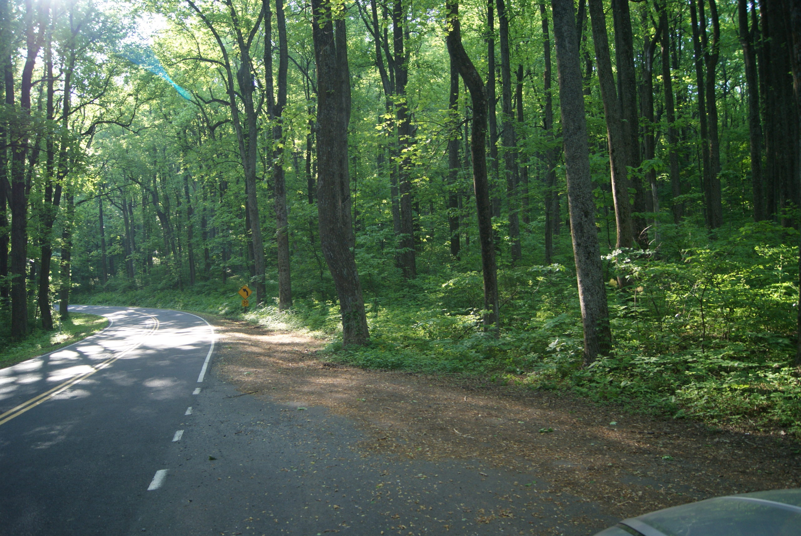
We had such a good time in April, spending a week at Shenandoah National Park with our daughter, son-in-law and grandson, that we were eager to return. On our April visit, the trees weren’t yet leafed out at the high altitudes. So, this visit, only a month later, looked very different.
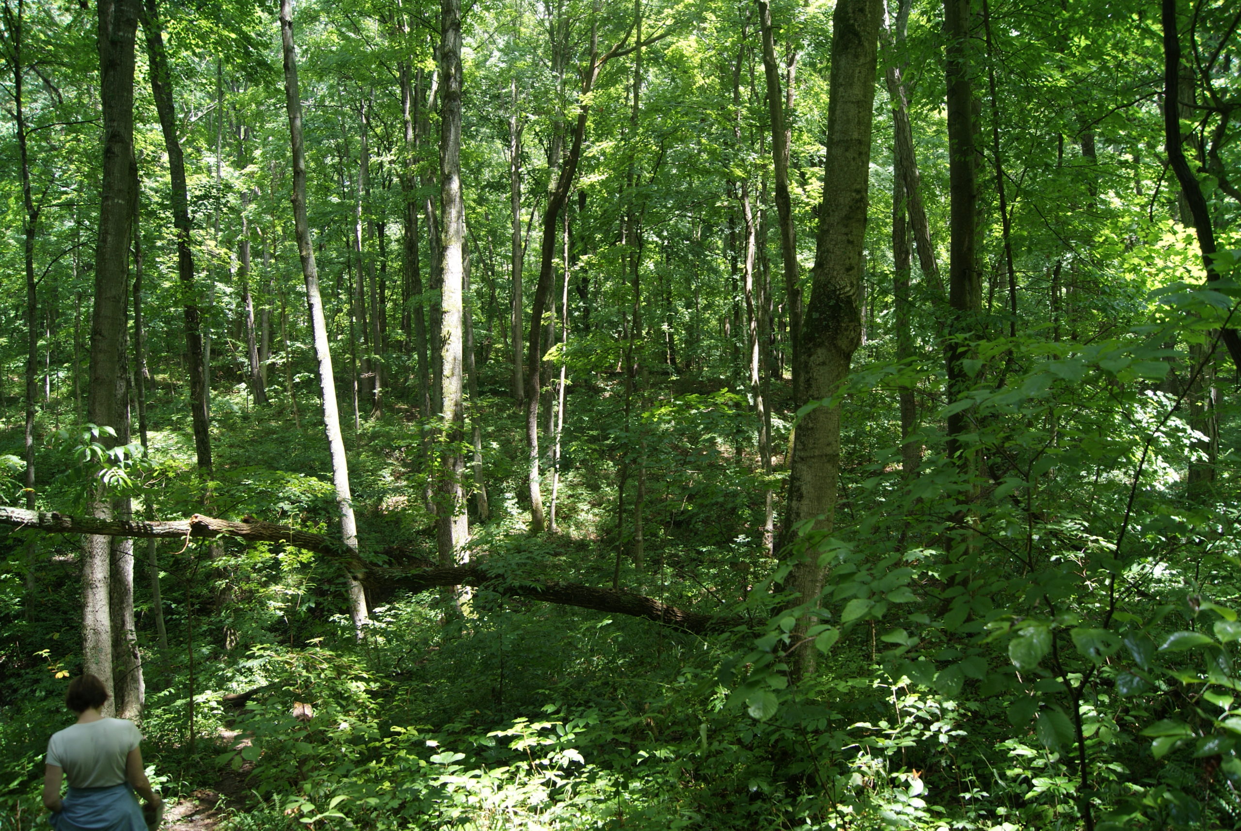
We hiked a different trail each day of our stay. The Limberlost, Traces, and Big Meadow trails are all short and level enough to be easy for a hiker with a bad back, like Al. Here are a few pictures from our hikes and our daily drives through the park.
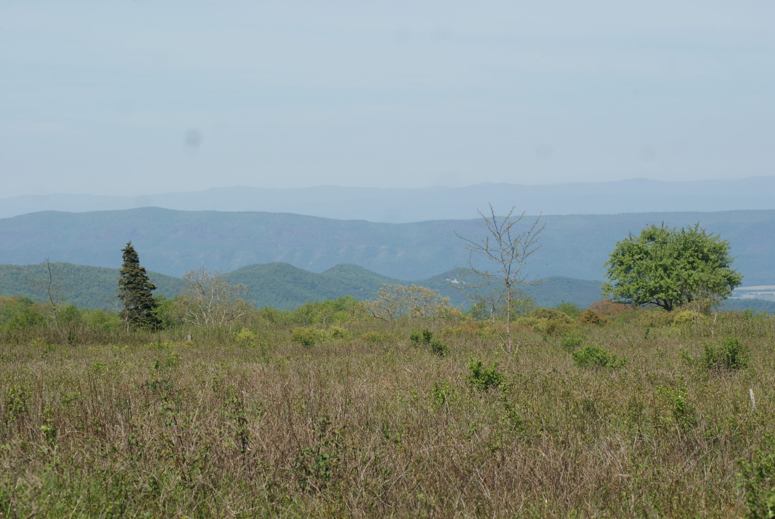
Clockwise from top left: Along the Traces trail; Big Meadow; A bluebird; My favorite spot in the park, about milepost 8 on Skyline Drive, is like a green cathedral; Layer upon layer of mountains like ocean waves.
A Hidden Gem of a Museum
We met the owner of the New Market Battlefield Military Museum. The painting behind me is of a young Robert E. Lee with Elvis hair!
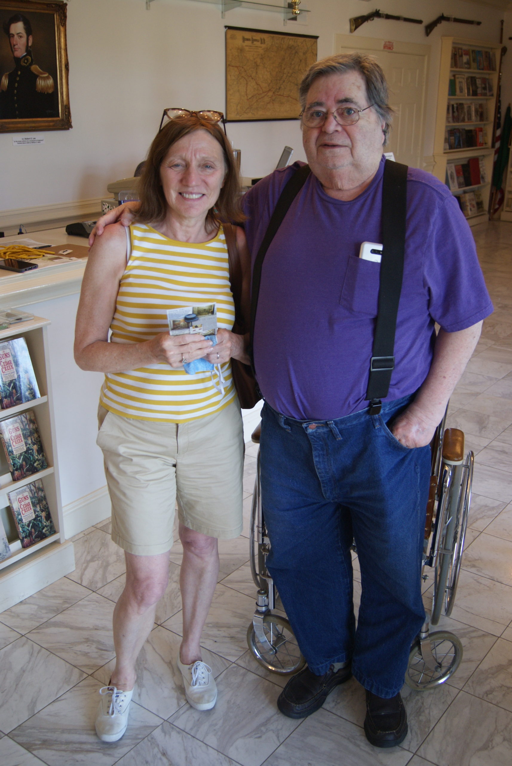
After a quick stop at the site of the Battle of Cross Keys, we drove to the nearby town of New Market intending to visit the Virginia Museum of the Civil War. On our way, we passed the New Market Battlefield Military Museum and decided to stop there first. It turned out to be a great decision.
This museum houses one man’s collection of military relics, primarily from the Civil War. The acquisition, preservation and display of these treasures has been his life’s work. The collection is vast, well-organized and well-displayed. Admission was only $12, and we ended up spending the whole afternoon there. We were lucky to meet the owner, John, and have a delightful conversation with him.
The collection includes everything from slave tags to John Wilkes Booth’s travel trunk to a lock of Robert E. Lee’s hair, as well as hundreds of original photographs of Civil War soldiers. The photographs are complete with names, unit identification and history, mostly organized by what battle they fought in. It also displays quirky items like a Sharp’s Carbine with a coffee mill built into the buttstock, and valuable artifacts like the sword that General Barksdale carried in Pickett’s charge.
And finally, our anniversary dinner
We chose ViNoVA Tapas & Wine Bar for our anniversary dinner on the recommendation of the desk clerk at our hotel in Front Royal. Another great choice. We selected seviche, shrimp, and a triple plate of cheese and meat, along with two different breads. Everything was delicious, and our server made it extra fun. Chris is the bar manager as well as a server, and the conversation with him was as good as the food. When I described a really good cocktail that I’d had years ago in New Orleans and forgotten the name of, he tried to reproduce it for me (and came really close). We also bonded over the use of the term “jagoff” in both Pittsburgh and his hometown of New York City.
Later, the owner, also named Chris, came out and we also enjoyed a chat with him about how he started the restaurant eight months before Covid hit and kept it going during the pandemic. The two Chrises made our anniversary extra special!
One our way out of Front Royal on Friday, we visited the site of the Battle of Cedar Creek, which will be the topic of my next post.
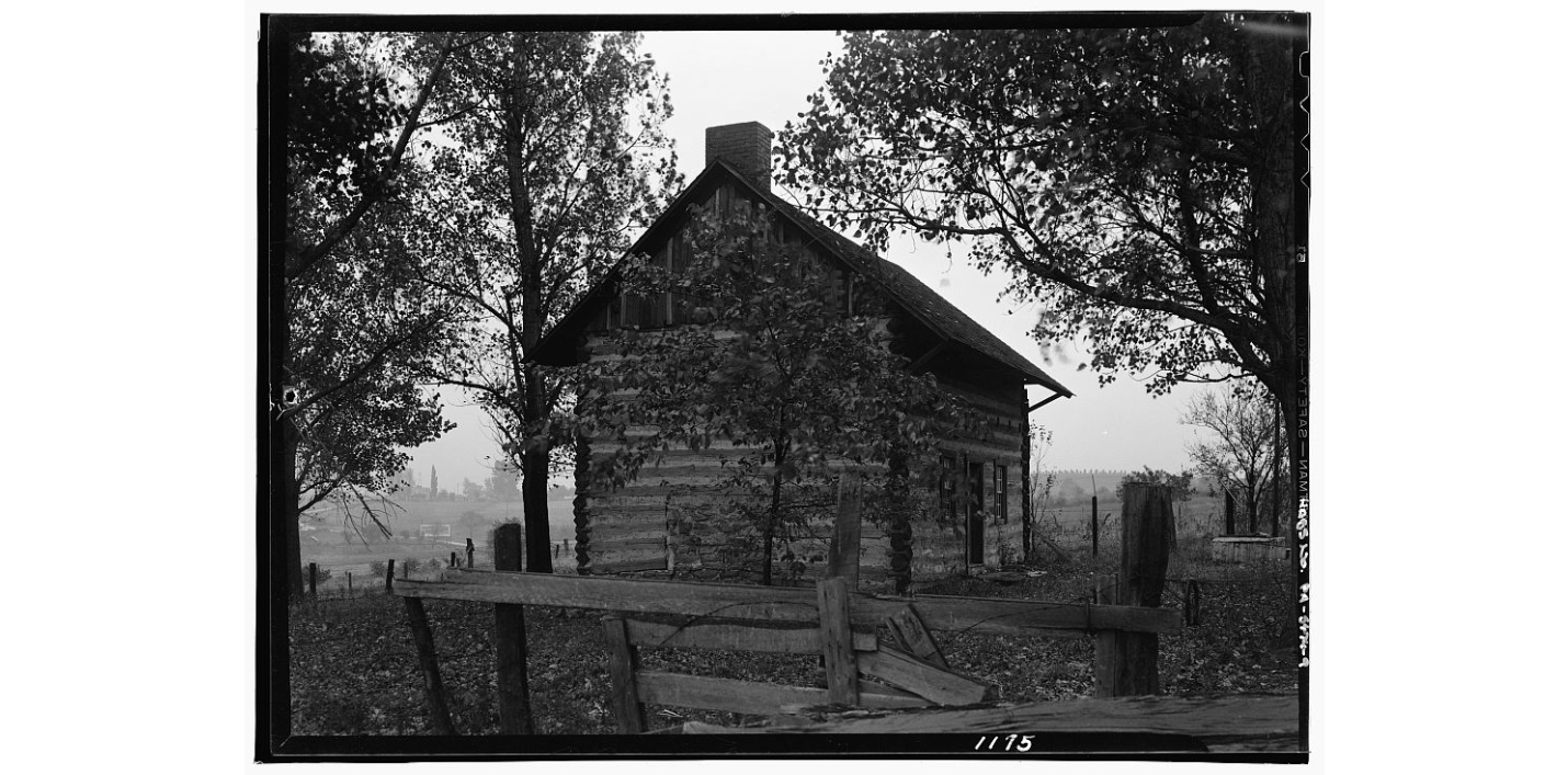
A little town with no fewer than three 18th-century log houses still standing. A 1784 inn that burned to the ground and rose again. And a monument to the unsung heroes of America’s pioneer age. These sights greeted me and Al on our most recent drive along the National Road.
Beallsville Early Days
We stopped first in Beallsville. The drive into town along Route 917 features a pretty stream, sun-dappled woodlands and beautifully-sited homes.
The 1784 Beall log cabin
The first significant building that you see when you enter the town is the 1788 log cabin of Zephaniah Beall, one of the town founders (984 Maiden St). The building is still occupied as a private residence. Robert Thornton was the area’s first white settler, in 1774. A few years later, he sold his land to Beall, Christian Kreider, and George Jackson. We don’t know why Beall got the town named after him.
Nineteenth-Century Beallsville
Beallsville thrived as a stage stop along the National Road in the early nineteenth century. Taverns, inns, stables, general stores, blacksmiths, and wagon makers served travelers along the busy road.
The Greenfield Tavern and hotel (also called the National Hotel) had an especially good reputation. William Greenfield also operated the Beallsville Savings bank in the building and printed his own bank notes which were treated as currency in Beallsville. After William’s death, his daughters Eleanor and Lewiza ran the business until they also died. The tavern closed in 1835, and the building was used as a general store and residence over the years. The building still stands at 2848 Maiden Street. It has recently been completely restored and is once again operated as a restaurant and store.
Greenfileld Tavern 2021 (on left)
Same view early 20th century. The buildings on the right burned down in the 1940s.
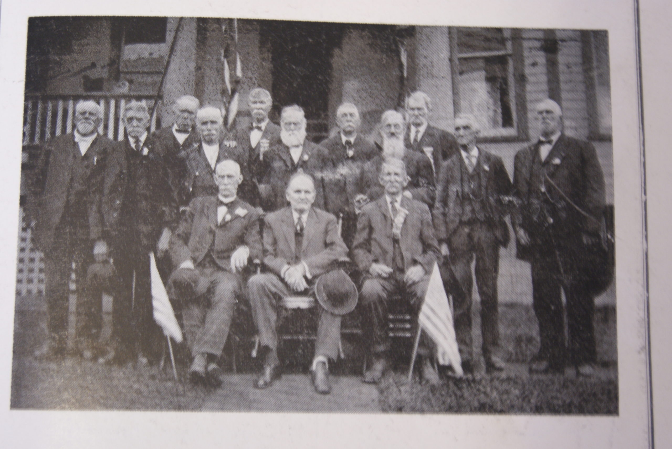
Ringgold Cavalry Reunion early 20th century
During the Civil War, Beallsville raised a unit called the Ringgold Cavalry, consisting of 70 initial volunteers, with 100 more added later. Led by a Beallsville doctor, John Keys, they were initially turned down as a cavalry unit by the State of Pennsylvania. The state was interested in infantry, not cavalry. But Dr. Keys persisted. He wrote directly to Secretary of War Edwin Stanton, who accepted the cavalry unit.
The last living veteran of the unit was Hopkins Moffitt. The captain of the Confederate unit, McNeill’s Rangers, who faced Moffitt in battle, declared him “the most intrepid” Union soldier that he faced in the entire war.
On a more personal note…
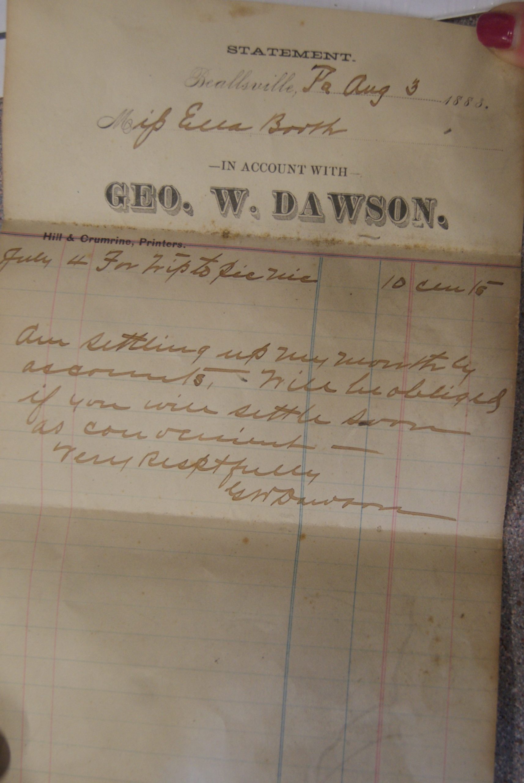
An 1883 Uber receipt
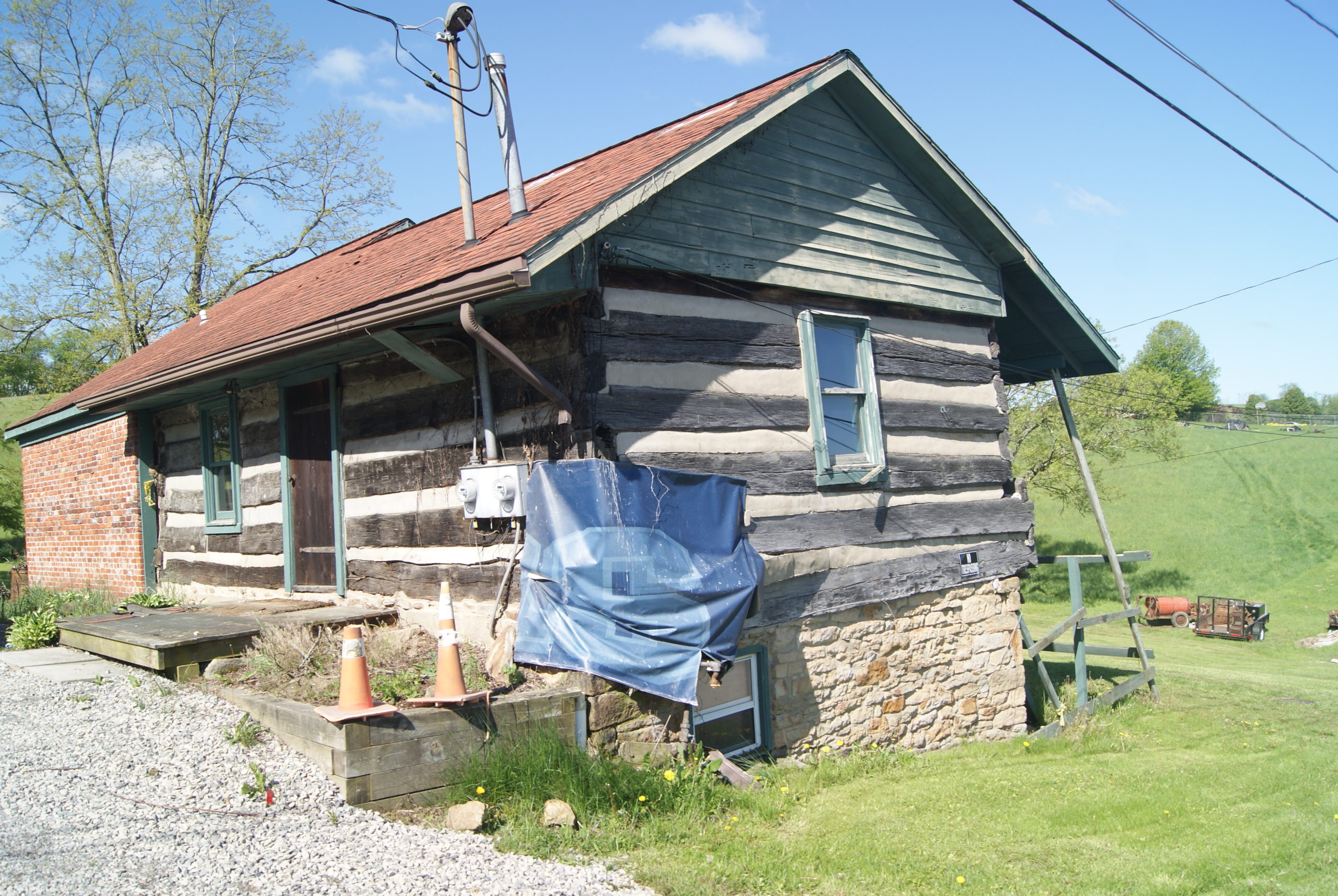
As we strolled Main Street, taking photographs of Beallsville’s well-preserved architecture, a local man was curious about what we were doing. We struck up a conversation and discovered that he was the owner of a fine 1852 house with an 18th-century log cabin on the property. It turns out that Mark is also a local historian, with family roots in the area going back to the 19th century. He offered us a tour of the log cabin – which was damaged by being rammed by a truck in this past winter’s snowy weather, and which he is hoping to repair and remodel. Mark allowed us to look at some historical documents in his possession, including town histories dated 1952 and 1976, and a receipt written to a former owner of his house, dated 1854: ten cents for a ride to town.
He also told us the story of an old woman who came to their porch one day in the 1990’s and told them that her mother had run a kitchenette from the back porch of the house in the 1890’s – called Etty’s Kitchenetty!
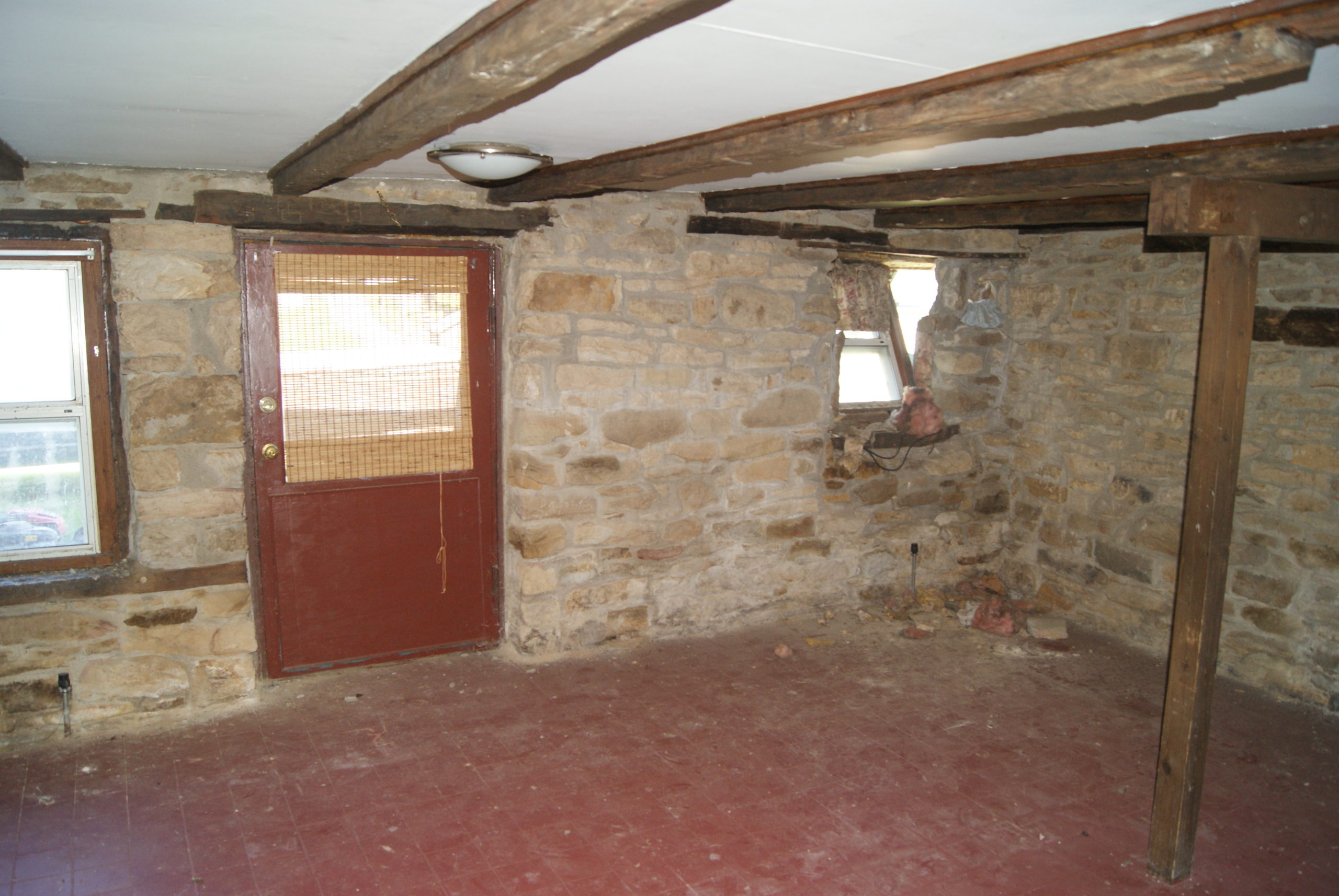
Below are some photos of the log house.
Log home exterior, showing impact point covered with blue plastic
Interior. The building was two apartments for several decades.
Beallsville Architecture
We saw a total of three 18th-century log buildings still standing in Beallsville, and there may be more. Beallsville’s old houses in general are very well preserved, representing almost 150 years, from the 1780’s to the 1920’s. Here’s a gallery of some of the prettiest examples.
Clockwise, from top left: 2872 Main St. (National Road), an Italianate building that once housed a bank; 11 Gay St., formerly the Beallsville school, this beautiful Romanesque style building now houses the community center, post office, and public works offices; An early 20th-century Craftsman-style bungalow; Late 19th-century Queen Anne; Another Craftsman bungalow; Beautifully restored Queen Anne; This duplex was once the home of Beallsville’s National Road toll-keeper
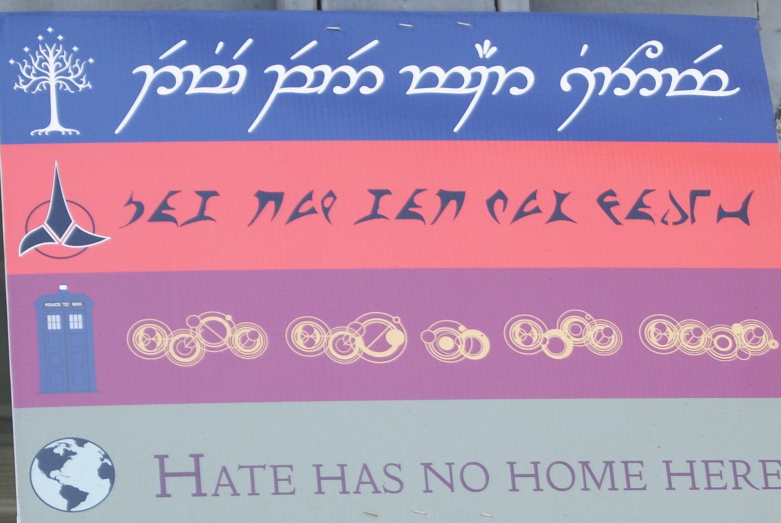
And, just for fun, I’m including this sign which we found on a down-on-its luck Queen Anne along the National Road in Beallsville. Do you know what the three languages are besides English? Answers in the Sources section!
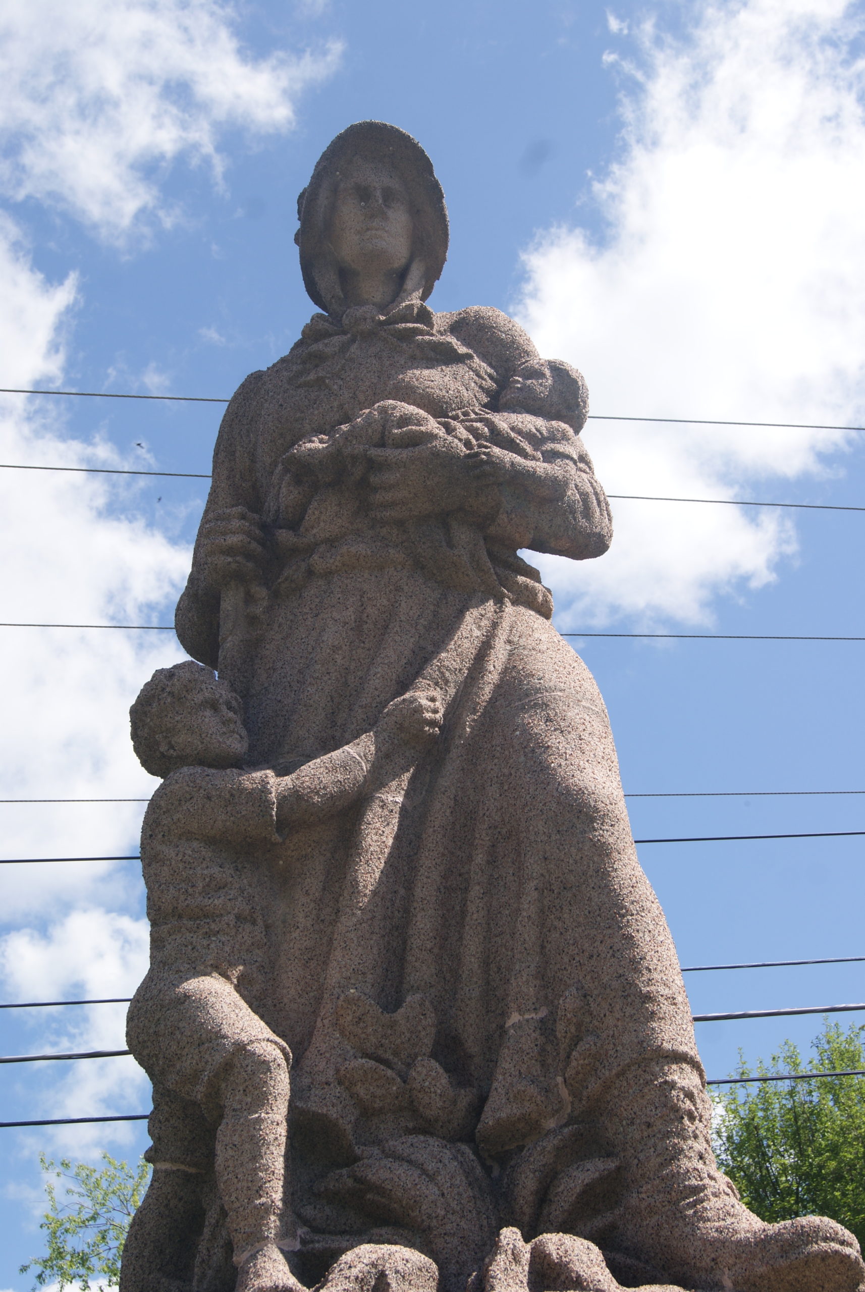
Madonna of the Trail
Madonna of the Trail
On our way between Beallstown and Scenery Hill, we stopped to see the Madonna of the Trail statue, a memorial to the pioneer women of the early 19th century. Commissioned by the Daughters of the American Revolution, one of these statues stands in each of the twelve states along the National Road.
The Pennsylvania statue was funded completely by contributions and dedicated by the Pennsylvania DAR on December 8, 1928. The woman depicted is homely and plainly dressed in heavy boots and a simple dress, but she emanates strength and courage.
Scenery Hill
Our last stop was Scenery Hill, home of the historic Century Inn. Like the Greenfield Tavern, it stands right along the old National Road, but predates it by a couple of decades.
The town of Scenery Hill was originally named Springtown when Isaac Bush first surveyed the area in 1785. Later, the town was renamed Hillsboro in honor of George Hill and his son Stephen, the original owner of what was called Hill’s Tavern.
Over the years, the tavern has hosted famous guests such as General Santa Anna, David Bradford, Chief Black Hawk, Andrew Jackson and the Marquis de Lafayette. Abraham Lincoln also visited and reportedly loved their breakfast.
Al and I were not such famous guests, but enjoyed lunch on the sun porch of the beautiful old building, meticulously decorated in period style. It was hard to believe that the building burned to the ground in 2015 and, over the following 2-1/2 years was lovingly rebuilt and restored. The original fireplace remains, as well as a step stone that led visitors from one building to the other.
Sources
Answers to the languages on the Hate Has No Home Here sign: Elvish from Lord of the Rings, Klingon from Star Trek, and . . . whatever the language is in Dr. Who.
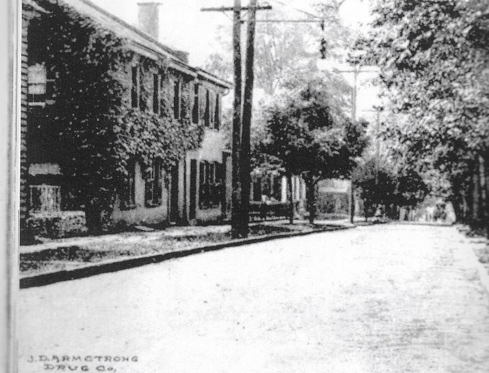
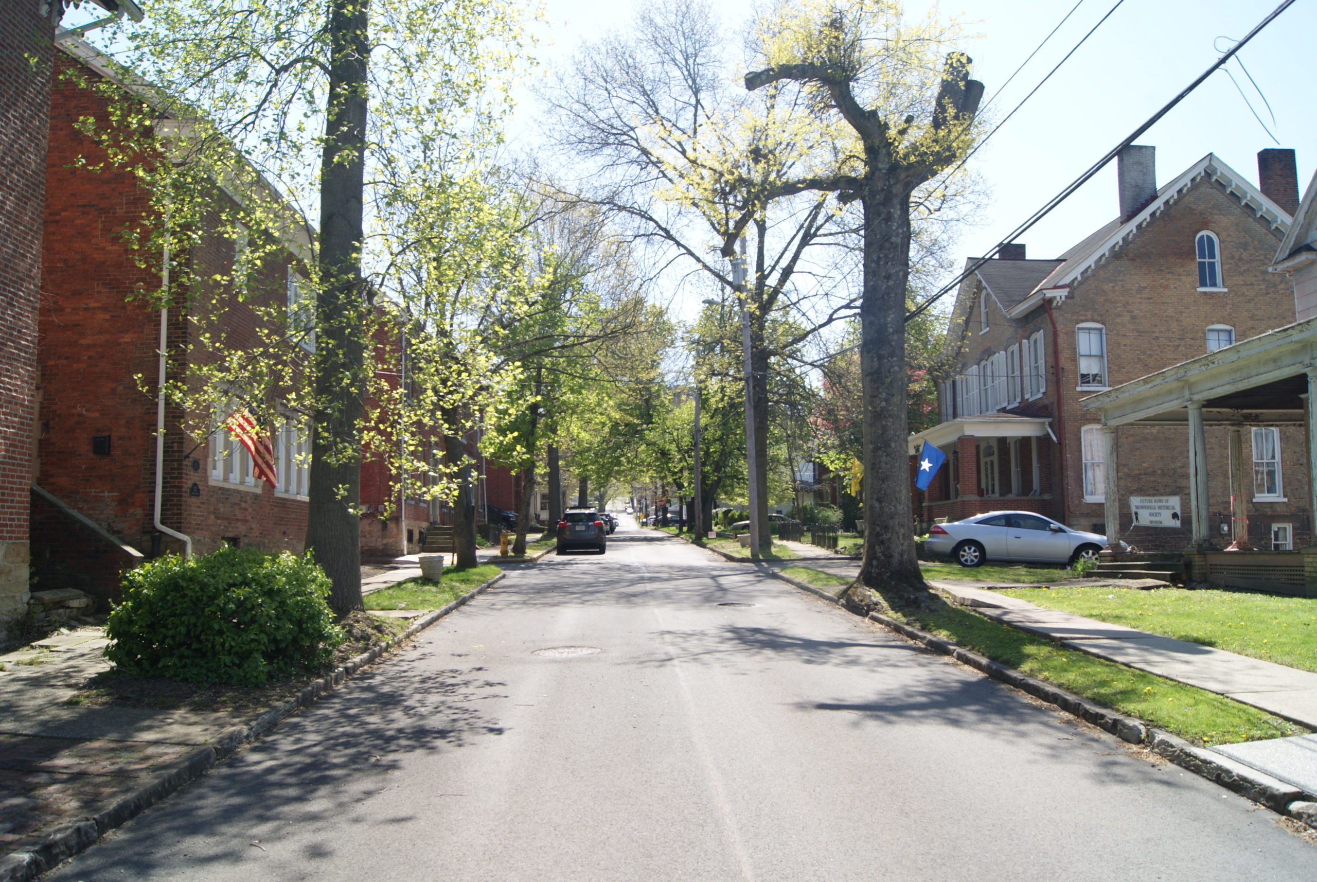
Three imposing bank buildings within two blocks, all of them shuttered and deteriorating. Whole blocks of boarded-up storefronts. Lots covered by the rubble of torn-down buildings. These sights first greeted us when we drove into Brownsville, our next stop on our tour of the National Road. We’ve seen many down-at-the-heels Pennsylvania towns on our drives, but Brownsville makes Uniontown look like Paris. The decay was truly shocking. Yet, signs of life appeared, too, and we found much that was worth seeing.
A Little Brownsville History
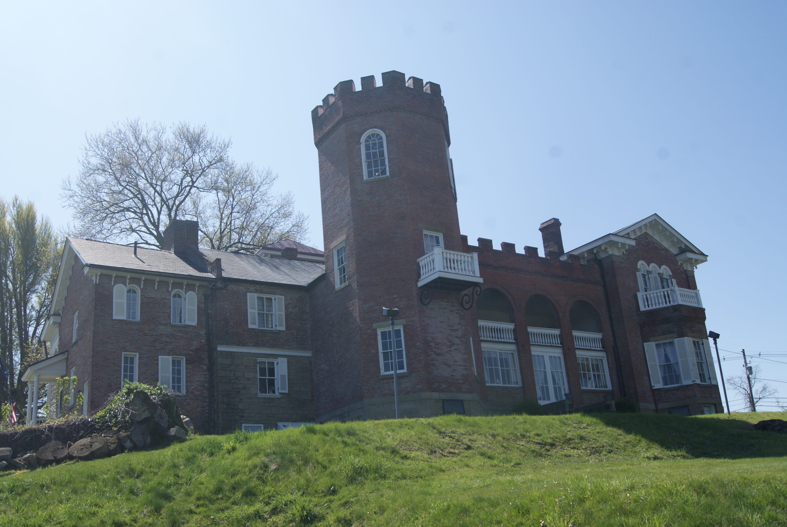
Nemacolin Castle
The view from the castle today
Indigenous people occupied he site of Brownsville for at least a thousand years before Europeans came. The indigenes had built earthwork mounds along the Monongahela, which the early European settlers called Redstone Old Fort. During the French and Indian War, a European fort, Fort Burd, stood on the site.
White settlers arrived in the area around 1785. An early settler, Jacob Bowman, built a trading post on the bluffs above the river, with his family’s home on the second floor. Back then, the town was still called Redstone. Jacob his wife had nine children. His heir, Nelson, and his wife had six children, but only two survived to adulthood. Nelson died in 1892 and left the house to his son Charles, who lived there with his wife well into the twentieth century. The Bowman family added on to the building several times over the course of the nineteenth century, and it earned the name Nemacolin Castle. It still stands today, with tours available by appointment.
The town in the shadow of the Castle thrived in the nineteenth century. Brownsville became a gateway destination for emigrants heading west by river, a transportation hub and a center of boat-building. Small industries related to steel-making grew up later in the century.
Like so many small industrial towns in our state, Brownsville declined in the late twentieth century. But lots of historical sites remain, some of them very well-preserved.
Brownsville’s Historic Buildings
The Flatiron Building
We stopped first at the Flatiron Building, which houses an art museum and a local history museum. Both are closed until further notice. But a peek through the windows and this review made us want to return when the museums are open. The building itself dates to 1835 and is owned by the Brownsville Area Revitalization Corporation.
Dunlaps Creek Bridge
A walk toward the creek below town puts you on the Dunlaps Creek Bridge, the first cast-iron metal arch bridge in the United States, dedicated on July 4, 1839.
Former home of the Black Horse Tavern
The building that housed the Black Horse tavern still stands on Front Street, next door to the Castle, although it has been modernized and expanded. The Black Horse was the site of the first public act of the Whiskey Rebellion, on July 27, 1791. Here, David Bradford and the other Whiskey rebels intercepted mail from Philadelphia to Pittsburgh, looking for evidence that civic leaders in both cities sought to put down the rebellion.
The Shreve house, built 1811
The Shreve House also still stands, at the corner of Front and Third Streets. Henry Shreve was a prominent local businessman, steamboat captain, boat-builder and inventor. Shreve is most famous for the 1814 construction of the steamboat Enterprise, which he also captained to New Orleans to deliver munitions to Andrew Jackson during the War of 1812. The city of Shreveport, LA, is named for him.
Brashear house (the one with the big garage)
The Brashear tavern and house at 519 Market Street, was built around 1796 by Basil Brashear. Lafayette addressed Brownsville citizens from the tavern door when he visited that same year. Basil Brashear’s grandson, John A. Brashear, was born in Brownsville and became a well-known Pittsburgh astronomer, inventor and educator.
Brownsville’s Historic Churches
St. Peter’s
Two historic churches also grace the town of Brownsville. St. Peter’s, at 188 Church St., is a Gothic revival building constructed in 1845. It houses the oldest continuously operating Catholic parish in Western Pennsylvania, and is believed to be the location of the first Christian services offered west of the Allegheny Mountains.
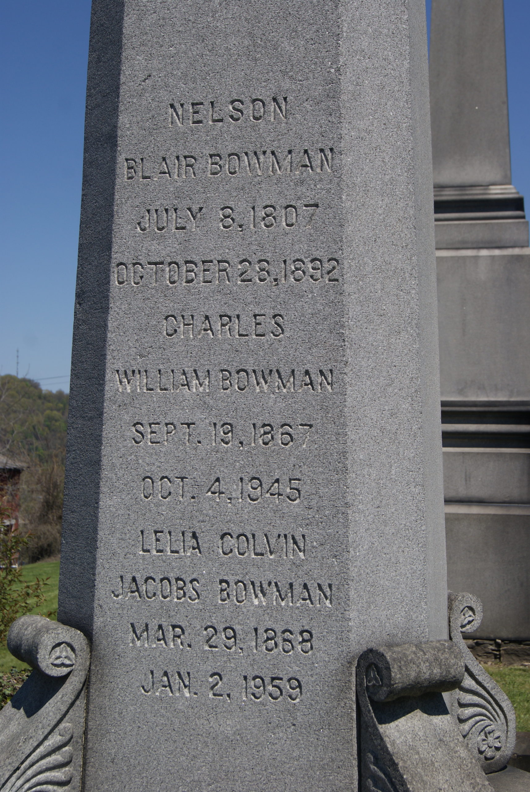
Christ Protestant Episcopal Church stands on the corner of Church and Fourth Streets. First organized in 1785 and served by missionaries, the first church building was erected in 1823. The current building dates to 1856. Thomas Brown, the founder of Brownsville, is buried near the church door. In the graveyard behind the church, you can also visit the graves of the whole Bowman family. They’re hard to miss; very large obelisks mark them.
Christ Protestant Episcopal Church
Brown’s grave
The Bowman obelisk
A Really Good Lunch – and a surprise bonus
Paci’s
When we do these drives, Al and I like to find a non-chain local restaurant for lunch. We found a great one on this drive: Paci’s in West Brownsville. They serve pub grub, but really, really good pub grub. The French fries were very crisp and not greasy. Al’s steak sandwich contained a real slab of steak, not chipped steak. And – bonus! – the restaurant building formerly served as the stable for a National Road Inn.
The inn also still stands on the site, now the private home of a Paci family member. While waiting for our lunch, we looked at the historical information about the inn that covers a whole wall of the restaurant. The inn, built in 1822, also served as a schoolhouse for many years. The stable was built in 1830 and was converted to a restaurant and bar in 1936. From 1895 until 1924, after the inn closed, the Grimes family owned and farmed the property.
Bonus Photo Gallery: then and now
We got so many interesting pictures in Brownsville that I wanted to include a few more of them. We found some great old photos in the Arcadia book (see Sources) from the town’s heyday, and I was inspired to take photos of the same locations today.
Front Street early 20th century
Front Street 2021
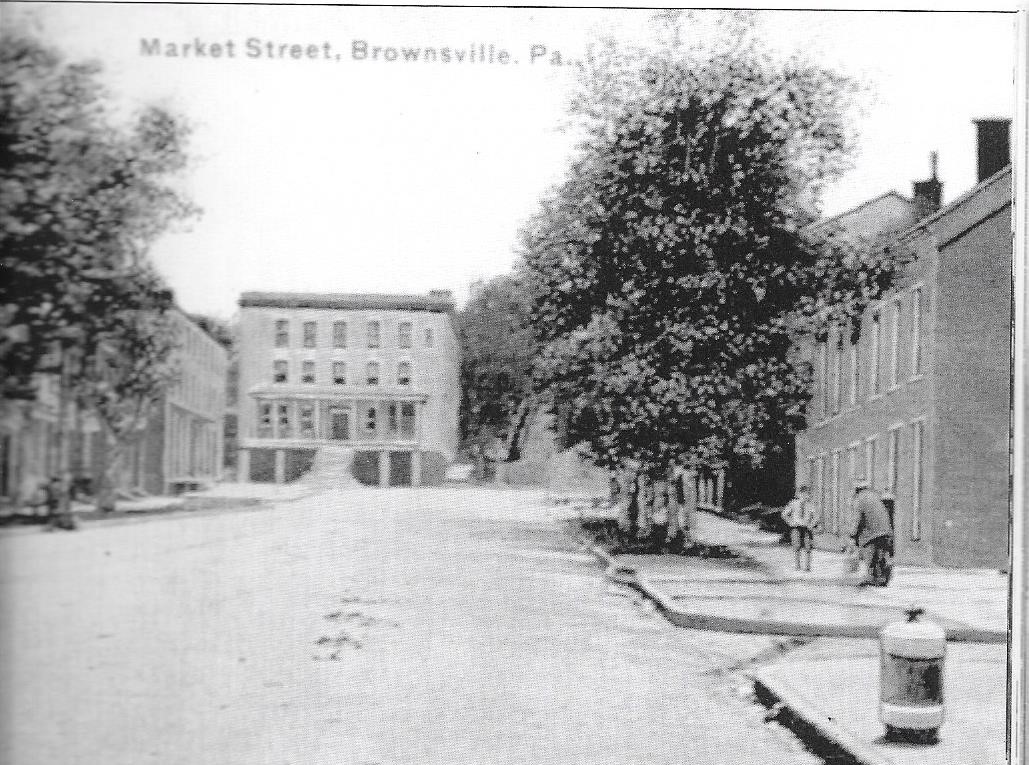
Top of Market Street late 19th century
“Top” of Market Street today
Downtown Brownsville early 20th century
Downtown Brownsville 2021
Flatiron Building early 20th century. The road to the right led up to Nemacolin Castle. It is closed now.
Flatiron Building 2021
Sources
Swetnam, George and Smith, Helen; A Guidebook to Historic Western Pennsylvania; Pittsburgh: University of Pittsburgh Press; 1976
Vivian, Cassandra; Images of America: The National Road in Pennsylvania; Charleston, SC: Arcadia Publishing; 2003
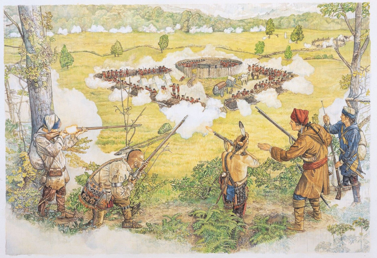
After I wrote my March 26th blog post about French & Indian war sites along the National Road, I remembered a story that I wrote twenty years ago and never published. It imagines a young soldier in Braddock’s fateful double-crossing of the Monongahela River in the summer of 1755 . . .
July 9, 1755
One year and eight months to go
Imagine moving an army through this!
The trees loomed in endless columns like an army of their own, on both sides of the narrow trail. An occasional languid breeze ruffled their very top canopy, but the humid forest was otherwise still on either side of the long, slow-moving line of soldiers, animals and wagons. The chirping whirr of locuts suddenly rose and fell, as if shrieking a warning.
Jamie’s boots trampled last fall’s leaves to dust and occasionally thunked awkwardly against rocks on the trail. Twigs snapped and leaves rustled, as they snagged on woolen sleeves. Wagon wheels creaked wearily as they had for the last one hundred miles and thirty-one days, up and down one tree-blanketed mountain after another, across rivers gurgling over ox-sized rocks bearded with black moss. Thin blades of light lent a white glow to a spot of fern-carpeted woodland floor. The army Jamie marched with had traveled the dim forest from Fort Cumberland, Maryland, to this dense, humid Monongahela River valley, claimed by the Penn family the Colony of Virginia, and, not incidentally, by King Louis, whose French soldiers and their Indian allies were sparsely entrenched in a small fort on a point of land where the Monongahela met the Allegheny.
This 1200-man army had been sent to dislodge that stubborn little outpost.
Jamie Grant, aged 18, short and broad-shouldered, scarred by smallpox, was the youngest son of a cottar family of the Scots lowlands and more recently the indenture of one Daniel Hamilton of Alexandria, Virginia. He knew little about the politics of the territorial dispute and cared less. Jamie marched toward the front of the column with the other blue-coated British colonial road-builders for a single reason: after two years’ service, and assuming that he survived and assuming that the French and their Indian allies could be dislodged, he would be entitled to fifty acres of land of his own. The British would allow him to keep his hatchet, his knapsack, his blanket and his gun, and whatever of his pay he could set aside, and start his own life as a land-owning man.
He had one year and eight months to go.
Jamie kept this thought firmly in his mind throughout the long days of clearing trees, hauling rocks to swampy patches of trail, and marching, marching, marching, mile after steep, forested mile. It kept him moving and it kept him from marrying about the Indians.
Ever since they’d entered the Monongahela valley, the army had been intermittently harassed by an enemy that seemed to emerge from nowhere, strike swiftly and then return to nowhere The column would find itself pelted by rocks for a few minutes. Supplies or horses disappeared in the night. Men learned not to stray from the main column, lest their scalpless bodies be found a few days later on the trail.
But Jamie resolutely turned his worries to something else. When he got his land, how would he know what to do? How did you make sure no other man could claim it? How did you commence taking down all the trees? Who cold tell you how to build a cabin? What did you do for…
“Jaysus Christ” screamed Ian MacIsaac in front of him, as an object dropped from a nearby tree, bounced off his shoulder and tumbled to the ground at his feet.
Distracted by the rustling above them in the tress, Jamie almost tripped over it before jerking back in horror, gasping. It was the scalped head of one of the unit’s stragglers, staring through crusted blood with still-panicked eyes.
Not death but capture
The mood was subdued when they settled down for the night. Jamie, MacIsaac, Mike Miller, and Dan Boone huddled near each other, sleepless.
“They want us to know they’s out there, that’s sure,” Boone remarked.
“Well, we know,” said MacIsaac.
Boone laughed. “You sure was a sight trying to wash that blood off your face and your jacket.” He imitated his friend, flapping at his face and squealing in a high-pitched voice, “Oooo! Oooo! Get it offa me!”
MacIsaac blushed and clenched his fists. “Easy for you to laugh! You wasn’t the one had a head fall on you!”
“Admit it,” Miller needled, “you’re scared of the Indians.”
“Hell, yeah, I’m scared,” MacIsaac replied, “and so’s anyone with any sense. I heard they cuts the eyelids off the ones they catch. And then you’re lucky if they kills you quick by hacking off your scalp. Some they burns to death, only they don’t do it quick. They takes their time, poking your skins with hot sticks, then when they finally sets you on fire, it’s a slow, roasting fire that kills you real slow. Hell, yeah, I’m scared.”
Miller enthused, “I’m ready for them. Remember that rabbit I shot back by the Yoxio Genhi? Right between the eyes at fifty feet! Just let some Indian try and get a jump on me.”
“That weren’t no fifty feet,” MacIsaac objected.
“And it weren’t right between the eyes, neither,” Boone pointed out.
“Okay, then, but I got it, and it was too fifty feet – or pretty near. You was there, Jamie. That was forty feet sure, weren’t it?”
“Yeah, I’d say forty,” Jamie agreed absently. He had avoided participating in the conversation because he didn’t want Boone and Miller to know that he was afraid. Secretly, he agreed with MacIsaac. The great fear that kept him awake at night was not death but capture. Thus far, the French and Indians had done no more than harass the long column and pick off a few stragglers. But everyone knew that the next day would be critical.
To avoid the obvious attack point of the narrow valley on the north shore of the Monongahela, General Braddock planned to make a double crossing: ford the river at a shallow point before the valley and re-cross at another ford to the west, beyond the dangerous cleft. The crossing points were the times when the army was most likely to be attacked.
Tension in the company had grown in the past few days, as the crossing neared.
“Yep, we’ll be crossing the Monongahela tomorrow,” Boone reminded them needlessly.
“Some’s saying the General’s making a mistake,” Miller whispered. “They’s saying we should take our chances with the ravine instead of taking the time to cross the river twice.”
“I think the General knows what he’s doing,” Jamie said.
Boone shrugged. “Maybe and maybe not.”
“We’d be sitting ducks in the middle of that river,” Miller whispered.
“Well, I don’t think the British Empire got made by idiots making bad decisions. We got an Empire because our Generals know how to fight, and I aim to do exactly what I’m told tomorrow and stay alive,” Jamie said. “And, now, I aim to get me some sleep.”
He lay down on his coat and turned his back to his friends. But he lay sleepless for a long time. He wondered if he would be brave tomorrow. He wondered if he would live.
This army’s in a panic
Miller was wrong. They made both crossings in complete safety the next day. Jamie felt a euphoric sense of relief, as if a huge burden had been lifted. His sodden wool uniform felt light and the road to the forks of the Ohio might as well have been ten feet wide and as flat as your little sister’s chest. He felt that he could run to Fort duQuesne.
Even the immense trees looked friendlier, like guardians instead of jailers. The splayed branches of hemlock and glossy leaves of mountain laurel reached into the trail like welcoming hands.
Jamie heard the ululating whoop and the crack of gunshot at the same second. The column stopped suddenly, clumsily, men tripping over each other as bodies fell in front of them.
Then the whoops and the gunfire surrounded them. Jamie heard a wet thud and a grunt, felt himself splatted with warm liquid and saw Miller fall to the ground beside him. He stared, paralyzed, for a mere second. Then, several of the blue-coated colonials run into the brush along the trail and Jamie’s instinct took him right behind them. He flinched and squeezed his eyes shut as a bullet cracked into the tree beside him.
Okay, okay, okay, just do what the officers taught you. Do what you practiced. Oh God, oh God, oh God, please help me.
With shaking hands, he groped in his box and drew out a cartridge. He brought it to his mouth and bit the end off. Trembling so much that half of it spilled, he poured a little powder in the pan and flipped the cover back over the pan, then hastily withdrew his ramrod and shoved the rest of the cartridge into the barrel of his musket. He tossed the ramrod aside, and pulled his musket up. But what to fire at? He could hear the attackers, but couldn’t see them. They were hiding, damn them! This was no way to fight. How could he get a shot if they wouldn’t show themselves? He squeezed his eyes shut again and blindly fired in the general direction o the high-pitched, staccato war whoops.
His heart was pounding and he was shaking from head to foot. He didn’t think he’d hit anything. He took a deep breath, reached back into his cartridge box and repeated his loading procedure. Damn! He’d thrown aside his ramrod! Where was it? He frantically scanned the fern-covered ground around him, then blindly groped through it. Where was that thing? He heard a cracking sound and felt a sharp stinging on his cheek. He raised a hand to his face and it came away covered with sticky blood and small splinters. The tree was shot again, then, not him. The narrow escape gave him courage. He twisted toward the trail, pulled Miller’s musket toward him, withdrew its ramrod and swiftly and firmly tamped it into his own weapon.
There! A bronzed body popped out of the brush only thirty feet from him, aiming a rifle. Jamie leapt up, raised his musket and fired without aiming, opening his eyes just in time to watch the body fall. I killed him! I killed me an Indian! he exulted and sank to the ground.
He felt a strong hand on the back of his coat and knew a second of panic before recognizing the voice of the British officer in charge of his unit. “Here, boy! Come out of there and fight like a man!” The officer shoved Jamie back onto the trail. “We’re forming a line about a quarter mile ahead. Get there on the double and don’t let me catch you skulking in the brush again or I’ll have you shot!”
Jamie leaned forward as he ran, trying to keep his head below the line of brush. The smell of gunpowder hung in the humid air, and shouted orders were drowned out by the crack of musket fire, the splintering of wood, the thwack-grunt of lead piercing flesh. He leapt over the occasional bloody body, but kept moving until he reached the line.
Incredibly, Colonel Waters was still mounted on horseback, shouting orders to the double line of blue and red coated soldiers, back to back on the trail, each line facing into the forest. Waters motioned him into a position at the end of the line.
“Fire!” Waters shouted, and the lines rose as one and fired into the dense woods. Immediately, fire was returned and Jamie watched several of his comrades sink to the ground. “Reload!” the colonel ordered and James joined his surviving companions in hastily reloading their weapons. “Ready! Aim!”
The men rose as one.
“Fire!”
Blinded by the smoke in the air and the sweat running into his eyes, Jamie pulled his trigger and quickly sank back to the ground. Another dozen or so men fell in a widening pool of blood.
Jamie already had another cartridge in his hand as the colonel raised his arm to begin the reload command. Suddenly, the colonel jerked backward and a burst of blood bloomed on his white vest before he fell, one foot still in a stirrup, body dangling under his panicked horse.
The men on the trail looked around nervously, waiting to be told what to do, but there were no other officers nearby. A few of the men glanced guiltily at their comrades before loping off down the trail. Others dropped their muskets and ran. Jamie held on to his musket and followed them, head down again, frantically butting anyone who got in his way. In his panic, he tripped over a body with its face blown to a featureless pulp, his chin hitting the rock-strewn ground. He picked himself back up and ran on.
He stopped only when he was blocked by a solid wall of read and blue wood coats. From a rise to their left, gunfire pelted down. The bodies were so packed together that men who were hit remaining standing, held up by the living. Jamie saw Boone and MacIsaac in the crush.
He grabbed hold of MacIsaac’s sleeve. “MacIsaac! Come on!” He dragged his friend into the brush along along the path. Boone followed them, swift as a hare.
The three crouched, panting.
“This army’s in a panic,” Boone shouted above the gunfire. “I think most of the officers is dead.”
Jamie wiped his sweaty, blackened brow with a sleeve. “Way I see it, we got only one chance, and that’s to make our retreat in this here brush.”
“But this is where the Indians is!” MacIsaac objected.
“Yeah, and can you see them?”
“No! That’s the trouble!”
“Well, then, they can’t see us neither if we stay along the side. It’s our only chance, MacIsaac.”
MacIsaac squeezed his eyes shut and nodded rapidly.
Boone gave Jamie a steady, appraising look for a second, then nodded once.
A clearing, a cabin and a man
This is actually the Neil log house which still stands in Schenley Park
It took the three men more than an hour to fight their way back to the Monongahela River, leaping from the shelter of one tree trunk to another, firing quick, mostly inaccurate shots when an enemy raised his head nearby. They seldom saw the enemy, but constantly heard him in the continuous crack of gunfire and the hideous, wailing war cries.
Finally, Jamie faintly heard the rushing and gurgling of the Monongahela over the waning din of the battle. He turned to MacIsaac and opened his mouth to shout to him, when the Indian came at him.
The moment seemed to last forever. Every detail of the man registered vividly in that instant: the hairless bronze chest, gleaming with an officer’s bronze neckpiece, the black-and-white face paint, the feathered earring, the rippling cable of arm muscle, lifting a tomahawk. I’m about to die, Jamie thought as he lifted his musket and fired. When he opened his eyes, the Indian was still coming, a blackened shoulder wound spurting blood, but still brandishing his tomahawk in the other hand. Heart pounding wildly, Jamie desperately shoved the butt of his musket into the man’s chin, then swung it the other way and hit the side of his head with the barrel. He heard a muffled crack as he made contact, and his enemy fell to his knees and then sank face down on the ground.
He glanced around for his companions and saw MacIsaac shoot down another approaching Indian. Boone was grappling desperately with a third. MacIsaac was frantically reloading his musket. Jamie scooped up the dead Indian’s tomahawk and ran at the struggling Boone. Without thinking, he swung the tomahawk down on the Indian’s neck and watched him collapse.
The three friends spun their heads around, but no more enemy approached. “Come on,” Boone yelled, already on the run toward the river.
Within just a few more yards, they slid down a bank to the river, snapping twigs and scattering small rocks ahead of them.
When they reached the river bank, they saw the remnants of the army splashing madly back across the river. Men fell and dropped their guns, scrambled back up and flailed forward some more, only to fall again. A few others dropped one foot in front of the other mechanically, shoulders sagging, guns long gone.
“Jaysus,” MacIsaac whispered.
“It don’t look like they’re being fired on,” Jamie observed.
“Well, then, you for it, boys?” Boone asked, and they began their own crossing.
Early in the dispirited, straggling retreat, few men spoke. Once they were safely away from the river and it was clear that there would be no pursuit, the army camped for the night.
Jamie, Boone and MacIsaac gathered as they had the previous night. They sat quietly for a few moments.
“I saw Miller fall,” Jamie said finally.
“He died right away?” Miller asked. “He wasn’t – “
“He died right away.”
MacIsaac sighed.
“Sure were a botch today,” Boone remarked. “I heard General Braddock’s mortal wounded.”
“So’s most of the officers: dead or wounded,” MacIsaac added.
The three friends were quiet again. I should be sad, Jamie thought. My friend is dead, our army’s beat and now I wonder will I still get my land after my two years is up. Instead, he felt something else. It wasn’t the euphoria he’d felt after the morning’s crossing, when he’d foolishly felt his way to the forks was clear. It was something harder and deeper. He was alive. He’d learned that he was no coward. But there was something else that he struggled to put a name to.
“Seems to me,” Boone said slowly, “them officers and regulars wasn’t much good anyway. The smart ones was the ones disobeyed orders like we did. And that thing we had to do by the river: nobody taught us that in no drill.”
Neither Jamie nor MacIsaac replied to this. But Jamie felt something opening up in his chest. It was a strange sensation, like fear and like excitement, and like seeing a clearing and a cabin and a man.
Since I am on vacation this week, I invited author Polly Hall to guest blog. Polly’s novel, The Taxidermist’s Lover, is the most unusual book I’ve read so far this year. The center of the novel is the relationship between Scarlett and Henry. And their relationship is deeply entwined in Henry’s profession of taxidermy. But Henry isn’t an ordinary taxidermist who’ll memorialize your eight-point buck with a nice mounting. With Scarlett’s encouragement, Henry begins to create bizarre hybrid creatures .
. The relationship between Scarlett and Henry felt sinister to me. The couple first meets and bonds over a dead creature washed ashore on the beach. Scarlett felt to me like she was attracted to darkness and – dare I say – monsters. I was curious about how Polly saw the love relationship when she was writing the book. If you like gothic romance, you will love The Taxidermist’s Lover. And if you’re curious about an author’s thought process as she creates this kind of chilling romance, read on. .
A brief analysis of Scarlett and Henry’s relationship – by Polly Hall
In The Taxidermist’s Lover, Scarlett, looks back over the past year, from Christmas Day, to try and make sense of the spooky goings on and her ill-fated love affair with Henry Royston Pepper, the taxidermist. As the reader enters into Scarlett’s head, they are drawn eerily into her thoughts and hear her addressing Henry and effectively speaking directly off the page as if a one-sided conversation or monologue.
The novel is written in second person narrative to reflect the intensity and closeness of their relationship. From the first line, ‘You are a wonderful, complex f**ked up mess,’ you once said to me.’ [p.3] the reader should be aware that this is not a flowery romance. It’s edgy and slippery. ‘It was the silence within you that viciously penetrated me.’
The age difference between the two becomes apparent with their physical descriptions – ‘you with your steady hands, me with the flighty grace of a starling’ and their behaviour, ‘you clasped me about my waist and lifted me effortlessly as if I were a child.’ Even the interaction with the modern world attempts to show the age gap – ‘I suggested a website for your business, but you looked at me as if I were suggesting you sell your soul to the devil.’ p.12 Henry is not interested in the internet and has traditional approaches to his work, yet Scarlett is the one who encourages him to diversify into making hybrid creatures. She sees the market leaning towards the contemporary art of Felix, the rival taxidermist, and feels Henry could also do this, and better.
Scarlett and Henry meet on a beach looking down at a dead creature washed ashore. This is not a normal meet-cute and if you believe in love at first sight this could be construed as already ill-fated, with death in the foreground of their ensuing relationship.
The petty jealousies and rivalry play out in the flooded, atmospheric landscape which becomes a character also vying for attention and on the periphery, there are other contenders: Penny, Felix, and even Scarlett’s pseudo-incestuous relationship with twin brother, Rhett. The weather affects both Scarlett and Henry, the changing landscape isolating and freezing them down as the end of the year approaches.
Secrets and other family relationships e.g. Rhett and Scarlett’s childhood are reflected upon and Henry shifts into a shadowy background role watching or making himself scarce by going to his workshop. Yet they are compelled back towards each other with an intense physical, almost animal attraction that is private yet exposed to conjecture by their choice to hide away on the moor. p.115 ‘There was not an inch of you I did not know, and I know you had mapped all of me too.’
And at the crux of the story the hybrid animals are there, silent witnesses to the unravelling with their cold, fake eyes staring out from the taxidermy mounts. Even in their intimate moments they are present.
‘When we made love, I’d somehow taste the essence of the creatures you’d been handling – the quick, acrid bite of a fox, the feathery scratch of an owl, the smooth perfume of someone’s beloved pet cat.’
Love is such a huge, indefinable subject but there is definitely warped obsession at play between Scarlett and Henry. All love stories have their dark, dirty secrets but THE TAXIDERMIST’S LOVER takes it to the extreme. I have been asked if Scarlett is suffering from mental health issues or were the supernatural elements ghosts of guilt? I’d like to let the reader decide here. The second person narrative lends itself to the unreliable narrator and seemed to fit the whole solipsistic viewpoint of Scarlett speaking to Henry from inside her head.
About the Author
Polly Hall
Polly Hall is a published author and experienced adult education tutor. Her debut novel, The Taxidermist’s Lover, was #1 New Release in Amazon’s British & Irish Horror and Bram Stoker Award 2020 Finalist for Superior Achievement in a First Novel. She has been published in various anthologies and commissioned as part of interdisciplinary arts projects. She holds an MA in Creative Writing and a PGCE in Lifelong Learning. She lives next to a cider factory with her cat, Vishnu.
In today’s post, we go back in time, to before Albert Gallatin conceived our nation’s first publicly-funded road, to a time before we were even a nation.
In the 1750’s, the British, the French and the six nations of the Iroquois Confederacy disputed the ownership of today’s American Upper Midwest. French traders and trappers pressed down on the area from Canada. The Iroquois hunted and farmed. And the British moved relentlessly westward from the Atlantic Coast, seeking land that could be settled and farmed. The three nations lived in a tense state between war and peace. The Iroquois Confederacy played off the two European powers against each other.
All three powers knew the location of the key to the Midwest. Southwestern Pennsylvania, where the Monongahela and Allegheny Rivers flow together to form the west-flowing Ohio. The vicinity of present-day Pittsburgh, Pennsylvania was about to be soaked with blood.
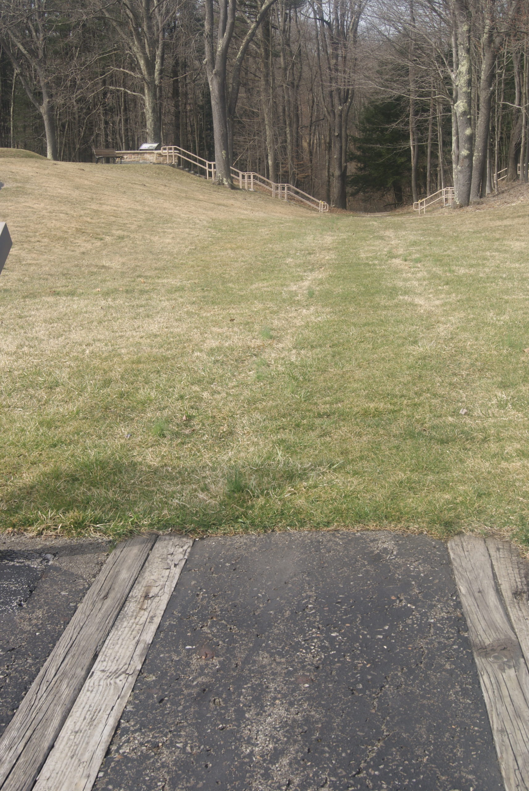
Monuments to the battle for the Midwest lie all along the National Road (present-day Route 40) between Uniontown and Farmington. If you want to see the important sites in chronological order, it’s best to see them travelling southeast from Pittsburgh on Route 40. Traveling in that direction, your first stop should be Jumonville Glen. This is where a young lieutenant colonel in the British colonial militia tipped the tense three-power balance into out-and-out war. His name was George Washington.
Jumonville Glen
Jumonville Glen
On April 18, 1754, a British crew building a small fort at the site of present-day Pittsburgh was driven off by a larger French force. Lieutenant Governor Dinwiddie sent Washington from Virginia to Pittsburgh with a small contingent of troops to protect the site. British and French accounts differ about how the skirmish of May 28, 1854 began.
We do know for sure that Washington’s forces ambushed the French who were camped at Jumonville Glen, about forty miles southeast of Pittsburgh. In the brief skirmish, Washington’s troops killed the leader of the French forces, Sir Joseph Coulon de Villiers de Jumonville.
The future Father of our Country won that battle – sort of. Imprecise accounts indicate that as many as a dozen Frenchmen were killed and thirty taken prisoner, against only one Virginian killed and a handful wounded. But Washington was forced to withdraw, and he had not heard the last of the Villiers family.
The short, wooded walk from the parking area to Jumonville Glen is very pretty, even in the early spring when the trees are still bare. Bright-green moss lines the path, and when you reach the overlook it is very easy to see how Washington could have taken the French by surprise here.
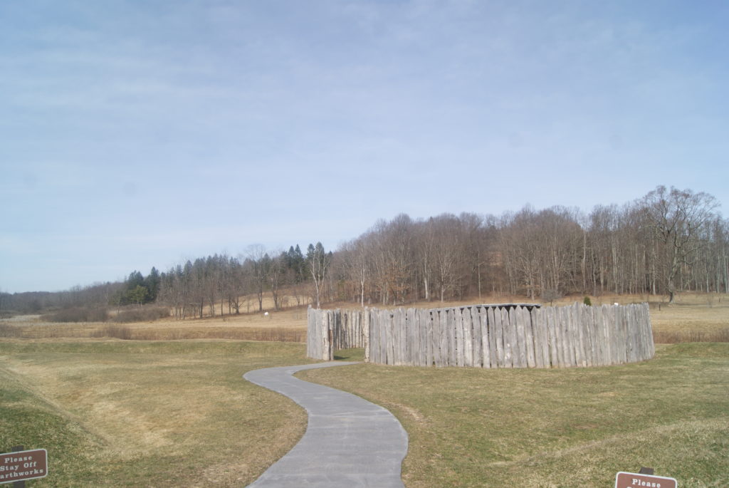
Fort Necessity
Driving southeast on Route 40, the next monument is Braddock’s Grave (see below). But, if you want to see the sights chronologically, your next stop should be Fort Necessity.
While Washington was skirmishing with Jumonville’s troops, a larger force of the French kept busy replacing the fort that the evicted British had started. They called their new fort Fort Duquesne. From there Louis Coulon de Villiers – Sir Jumonville’s brother – led six hundred troops southeast to avenge his brother’s death.
This depiction shows how open the ground was around Fort Necessity
Washington expected the French to strike back and he made preparations. But he didn’t do a great job. He ordered his troops to rapidly erect a defensive fort at a site called Great Meadows. The location of the fort was a dream come true for the attacking French. It was flat and open, surrounded by trees that provided cover for attackers.
The ground was also swampy, and, as it happened, the coming battle would be fought in a driving rain. By the time Villiers offered surrender negotiations, thirty of Washington’s men had died in the flooded trenches, and seventy more were wounded.
Because he wasn’t sure when the British might be sending reinforcements, Villiers was surprisingly generous in his terms. The remaining Virginians, including Washington, were permitted to return to Virginia. But the light was poor, and the surrender document was written in French and poorly translated to Washington. So, he was unaware that he had just signed an admission to having assassinated Sir Jumonville.
Washington’s troops abandoned the fort on July 4, 1854.
The French had won – for the moment.
Fort Necessity National Battlefield Park
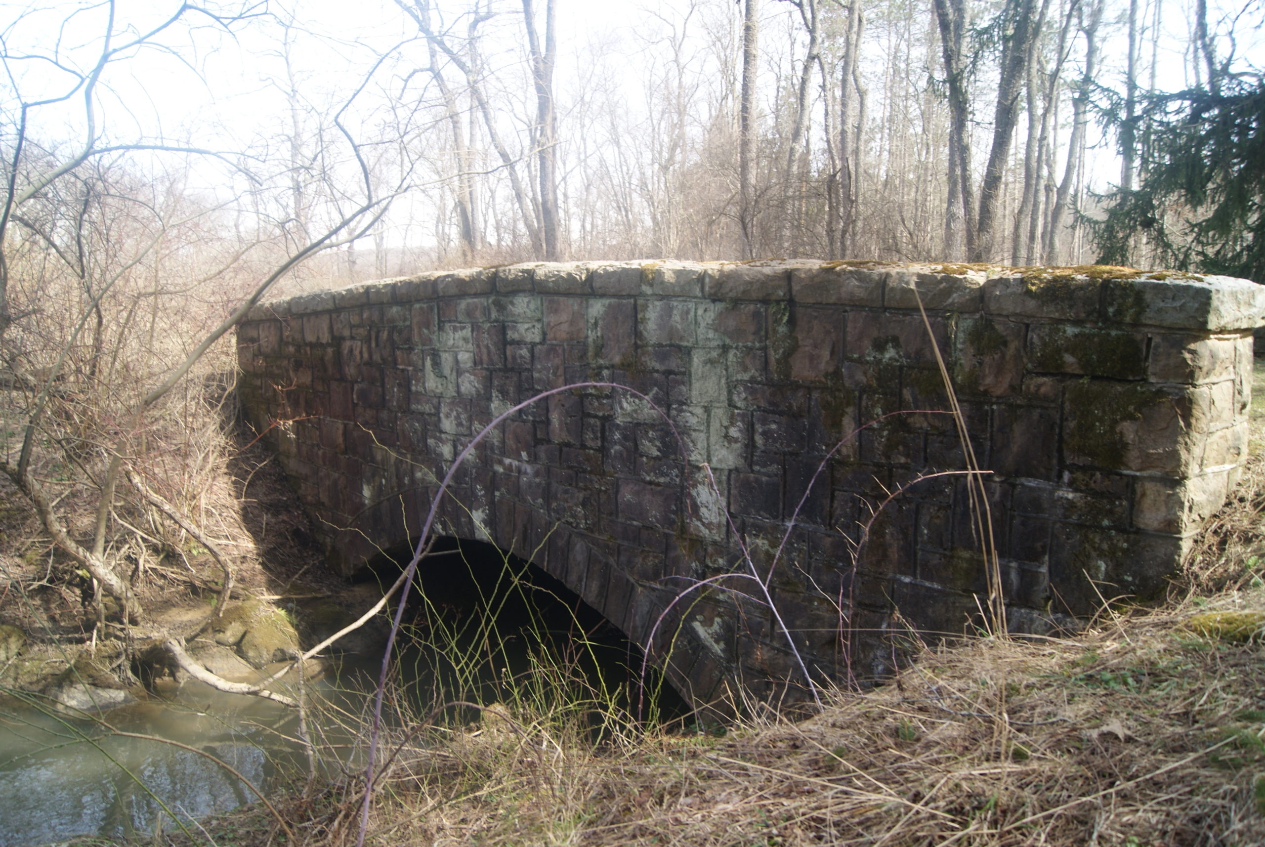
The national park at Fort Necessity has vastly improved since our first visit there. When we first visited in 1984, the park consisted of a reconstruction of the fort and a few signboards. Since then, the National Park Service has constructed a large new museum building with an ample parking lot, a movie theater, a fort-themed outdoor playground for children, and a gift shop. Excellent displays describe the history of the National Road and the fort. The grounds of the park also include Mount Washington Tavern. From the museum building, it is an easy walk to the fort reconstruction and a rather more strenuous walk to the nearby tavern (see below). You can also reach the tavern directly from Route 40. The grounds are lovely, dominated by stately pines, and knit together by well-shaded paths.
Despite its location just a few hundred feet from Route 40, the site of the fort was very hushed when we visited. It felt almost haunted to me in the stillness. I felt like if I stepped off the path onto the grass, I would step back in time and face the fort as it looked on that dismal July day in 1754, smell the wet gunpowder, and hear the cries of the wounded.
During the Depression, the Civilian Conservation Corps made some improvements to the Fort Necessity site. They built an especially handsome, sturdy bridge, which still stands.
Fort Necessity reconstruction
The CCC Bridge is still in use for foot traffic
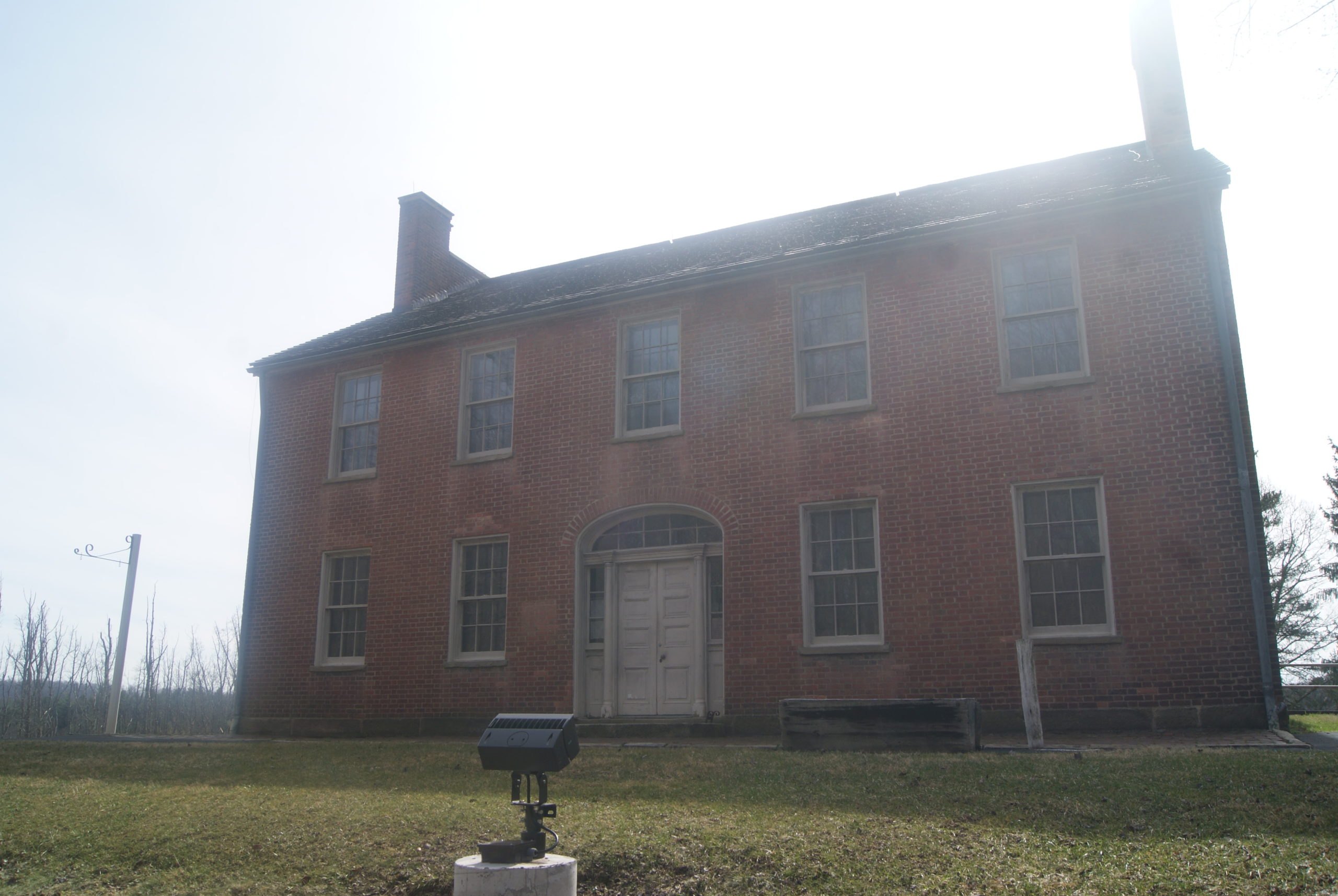
Mount Washington Tavern
Washington Tavern
The tavern standing on the grounds of Fort Necessity National Battlefield dates to the heyday of the National Road. Built in the 1830s, it served travelers on the Good Intent stagecoach line. It was closed when we visited, but is normally open May – October from 10 a.m. until 4 p.m.
The Braddock Expedition
Backtracking northwest a little on Route 40, we come to the last chronological stop on our tour of the French & Indian War section of the National Road.
The battles at Jumonville Glen and Fort Necessity triggered the world’s first true world war. Western Pennsylvania was the starting point and epicenter of the nine-year conflagration known as the Seven Years War or the French & Indian War. But the war ultimately pulled in Prussia, Spain, Austria and other allies of both the French and the British.
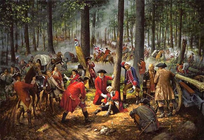
In the summer of 1755, early in the war, the British made another attempt to capture the all-important site of present-day Pittsburgh. General Edward Braddock set out from Cumberland, Maryland, with 2100 troops. How do you move that many men, along with their cannons, provisions and other equipment, through a heavily forested Appalachian wilderness? You build a 110-mile road, of course. And the road that you build becomes part of the route of the National Road six decades later.
The Braddock expedition included such future luminaries as Daniel Boone, Horatio Gates, and the 23-year-old bumbler who started the whole mess – none other than Lt. Col. George Washington. The presence of so many soon-to-be-famous men didn’t help Braddock much, though.
On July 9. 1755, soon after they had crossed the Monongahela about ten miles south of Pittsburgh, Braddock’s force was surprised by a much smaller force of French and their Indian allies. The terrain favored the French and Indians. After several hours of combat, Braddock was shot off his horse and killed, and the British began to withdraw. Only firm action by Washington prevented the withdrawal from collapsing into panic.
British victory at the forks of the Ohio would have to wait for the Forbes expedition, three years later.
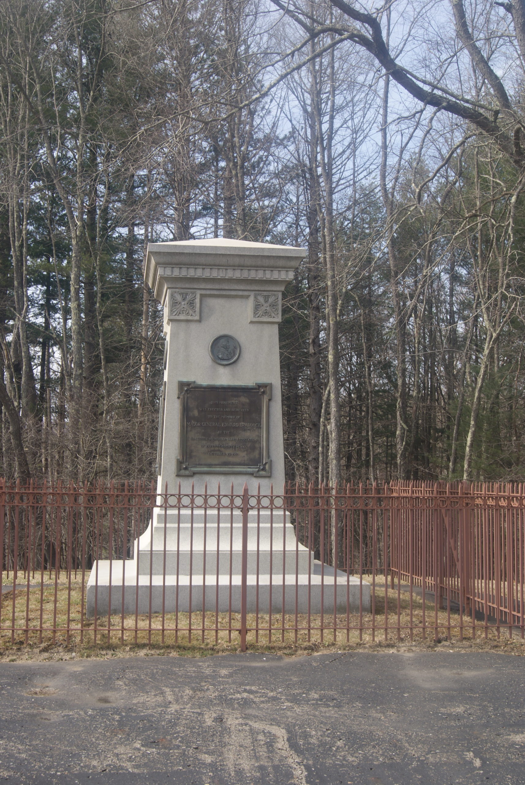
Braddock’s Grave
The British originally buried Braddock on the road they had so laboriously built. In 1804, workers repairing the road discovered the body. They reburied it on a rise above the road, where it remains today under a granite monument.
A stop at the very-visible monument also gave us the opportunity to see a couple of hidden gems nearby: the original Braddock gravesite and some preserved remains of Braddock’s original road – mere feet from today’s Route 40.
Traces of Braddock’s Road
Braddock’s grave
Coda
In 1771, George Washington bought the land on which Fort Necessity had stood. He saw that the grounds lay along what would eventually be a well-travelled route west, and thought it would be a good investment. He visited the property in 1784, but sold it before his death in 1799.
The British won the Seven Year’s War and gained an empire. Ironically, their empire nearly bankrupted them just a couple of decades later, and it has since faded into history like all empires.
But the road that Braddock and his men started has survived, first as the National Road and now as Route 40. A traveler named Aldara Welby, quoted on one of the museum signboards, said it best in 1819. “The National Road is a work truly worthy of a great nation, both in its idea and construction.”
Next Up: I will be on vacation in early April, so Polly Hall will be my guest blogger. Polly is the author of The Taxidermist’s Lover, the most unique and imaginative book I’ve read so far this year.
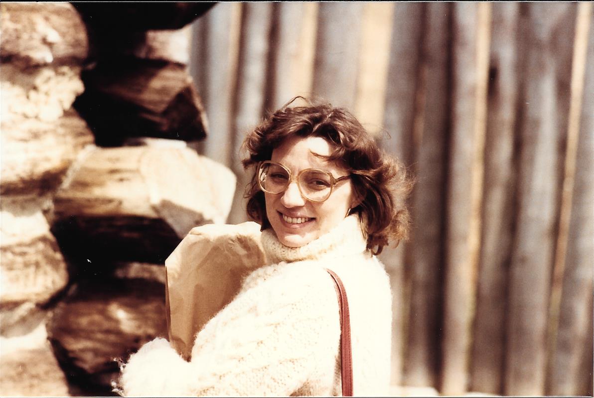
And, finally, just for fun, here’s a picture of me on our first visit to Fort Necessity, in March of 1984. I was 8 months’ pregnant!
Vivian, Cassandra; The National Road in Pennsylvania; Arcadia Publishing, Charleston, SC, 2003.
Also: the Pittsburgh Public School System. When I was student in the 1960s and 1970s, every Pittsburgh school child was taught this history and it is as familiar to me as a family story. I only needed my sources for exact names and dates.
I wrote a little about Uniontown’ history in my last post about the National Road. This week, I continue with some detail about Uniontown’s architecture and its historic heroes.
Uniontown’s Architectural Gems
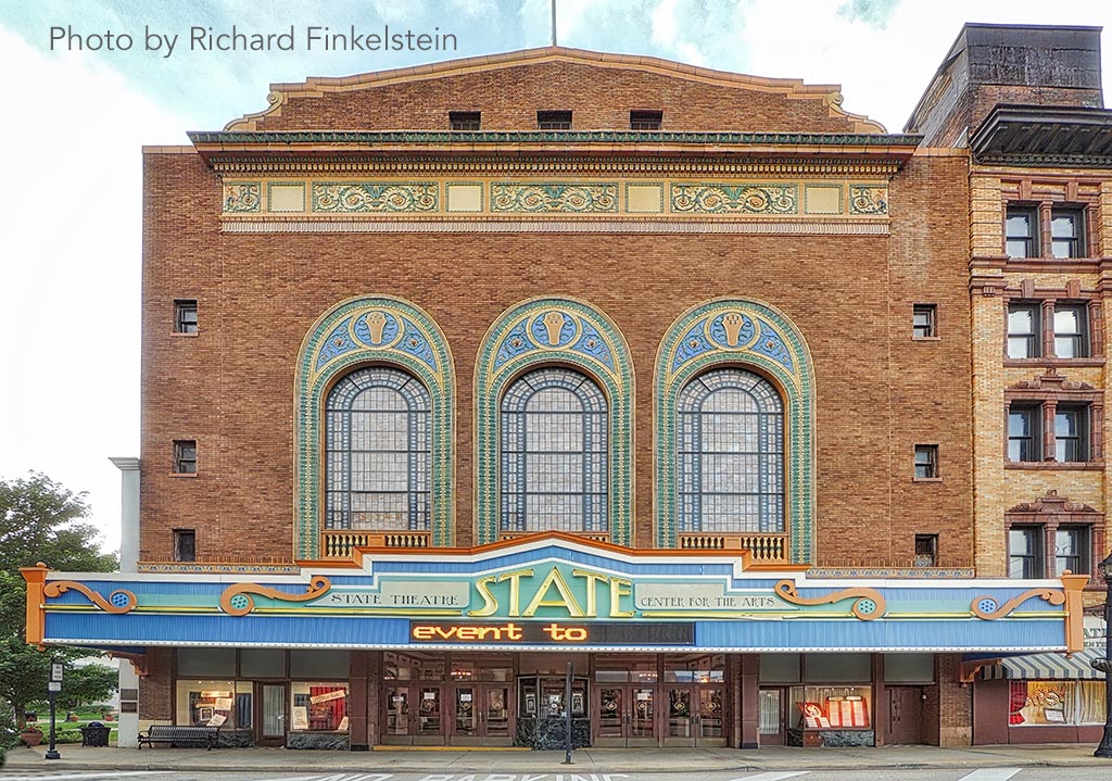
Uniontown’s loveliest building is the Beaux-Arts State Theater Center for the Arts. Designed in 1921 by prominent theater architect Thomas Lamb, it opened on October 30, 1922 to acclaim as the “largest, finest and most beautiful playhouse in Pennsylvania.”
Originally hosting vaudeville shows and silent films, the theater also showcased nationally-popular big bands like Paul Whiteman, Glen Gray, and the Dorsey Brothers in the 1940s. Like so many grand theaters, it lost much of its audience in the declining mill town and closed in 1973. The theater was purchase in 1988 by the Greater Uniontown Heritage Consortium. Today it presents everything from classic films to local dance recitals.
Here’s a gallery of some of the other little gems that we discovered on our walk through downtown Uniontown.
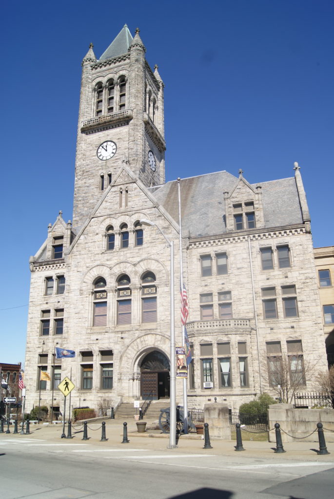
Fayette County Courthouse built 1890
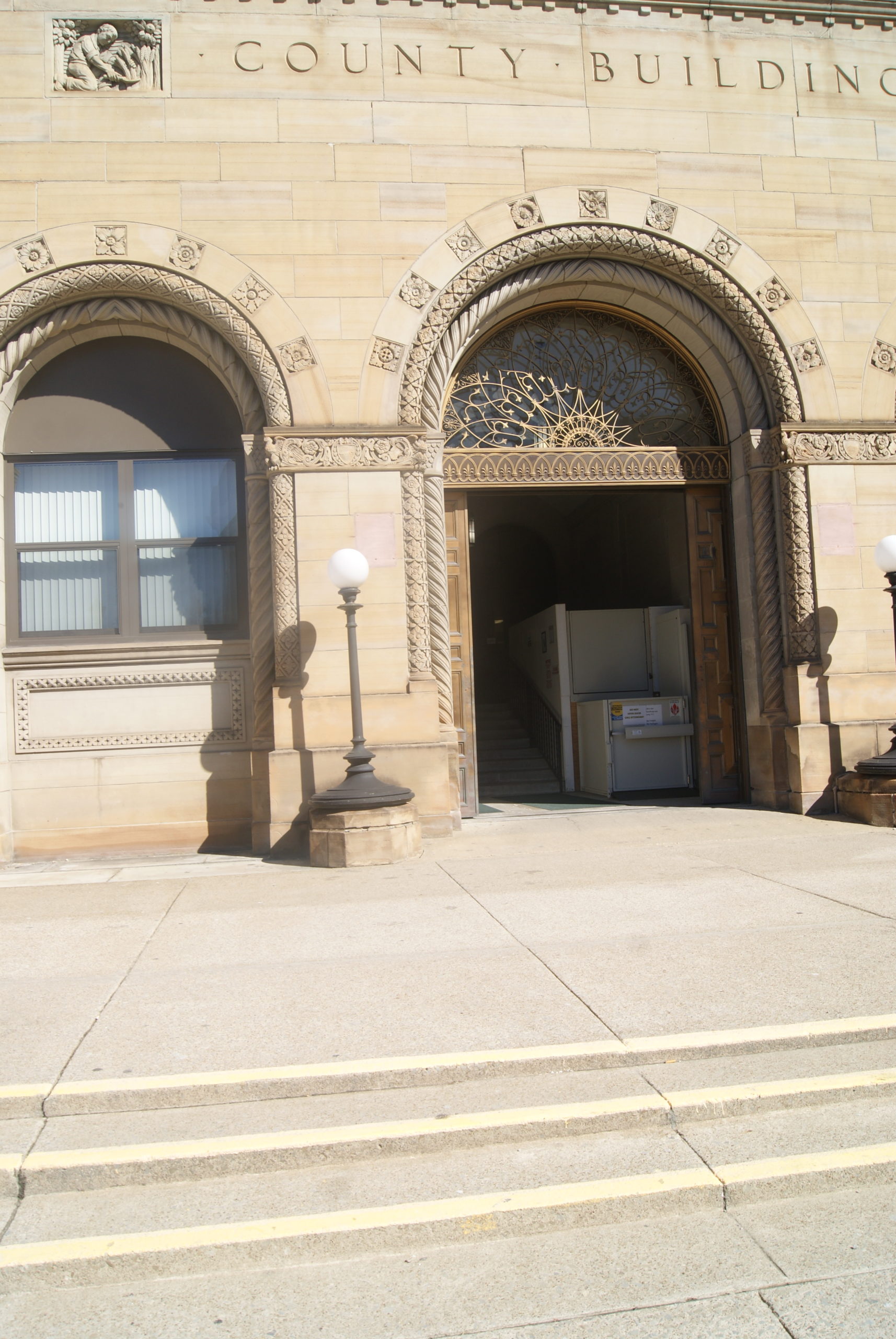
Courthouse annex with beautiful stone relief carvings and ironwork transom
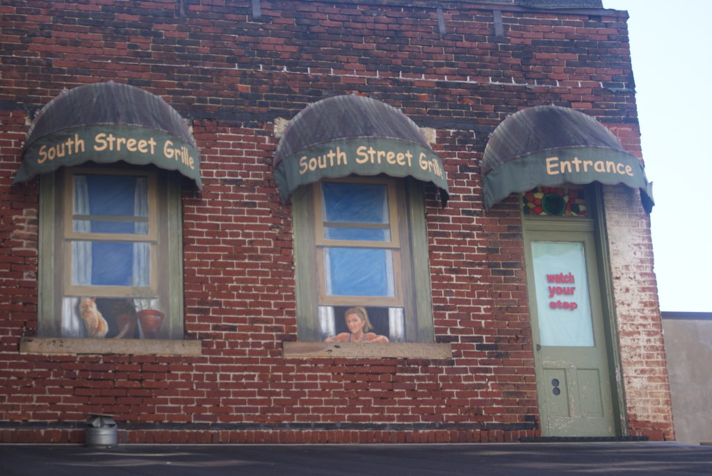
Love this trompe l’oeil
And love these fancy cornices!
But, to my surprise, what impressed me the most about Uniontown was its history of heroism, and its commendable civic habit or honoring heroes.
Uniontown hero: General George Marshall
Uniontown’s best known local hero is General George Marshall. Marshall was born on December 31, 1880 and raised in Uniontown, where he was known by the nickname “Flicker.” Marshall’s father was a well-to-do coal magnate, who sold his mining business to invest in real estate. He lost enough of his money that the family begged food from a local hotel for a while.
Although he was a notoriously poor student, young George somehow managed to be admitted to Virginia Military Institute. There, his poor academic performance continued. But he thrived under the military discipline and a moral culture dedicated to service, chivalric courtesy, self-control and integrity. The young cadets were taught to emulate great men like George Washington and Pericles.
Marshall took his moral lessons to heart. He became so tough and self-disciplined that he once was injured early in a football game and nevertheless played the entire game.
Under the discipline at VMI, Marshall became fanatical about neatness, organization and attention to detail. This stood him in good stead in his military career, as he gained a reputation as an ace at logistics, planning and administration. These organization skills made him so valuable to his superiors that in World War One he never saw the combat that he deeply desired, although he was often at the front lines observing and reporting.
Marshall had a strong commitment to the Army, but he wasn’t necessarily a traditionalist. One the eve of World War Two, Roosevelt placed him in charge of Infantry School at Fort Benning. There, Marshall shook up the old-fashioned methods of training officers to lead troops in battle. Many of the most important officers to serve in WWII were trained under Marshall’s revised methods. He trained his officers to think or their feet and taught the maxim that a mediocre decision taken in time is better than a perfect decision that comes too late.
The Marshall Plan
Marshall was FDR’s Chief of Staff during most of WWII, and served as ambassador to Chine from 1945-47. But he is best known for the war recovery plan that he developed for Europe in 1947, known to history as The Marshall Plan. Between 1948 and 1952, the United States allocated over $17 billion ($130B in today’s dollars) to the economic recovery of war-devastated Western Europe. The Plan saved thousands of Europeans from starvation, allowed the end of rationing and reduced the influence of Communist parties in Western Europe. It was a precursor to NATO, the European Economic Community, the Bretton-Woods international monetary agreement and the European Union.
The Marshall Plan offered help to the USSR and the eastern bloc countries, too, but they turned it down. Seems like a bad decision. When the Marshall Plan began, per capita Gross Domestic Product in both the east and the west was $2000. By 1990, Western Europe boasted a per capita GDP of $20,000. The comparable figure in the East was only $9000.
A fine statue of Marshall stands in a little square in downtown Uniontown, honoring a man who started as a poor student in Uniontown and ended up changing the world.
Uniontown heroes: The 1894 coal mine strikers
I wrote in my previous post that coal mining was one of Uniontown’s main industries in the 1890s. In 1889, 65,723,110 tons of bituminous coal were mined in the United States, employing 300,000 miners and other workers. Nearly half of all naval ships in the world burned for fuel bituminous coal mined in the Appalachian region.
Back in the days before the Federal Reserve and floating currencies, Panics used to periodically hit the financial sector. These Panics then reverberated across the whole economy, and the Panic of 1893 hit coal mining especially hard. Factories reduced or ceased production and fewer trains criss-crossed the country, which reduced demand for coal. The mining companies reduced wages in 1893 and again in 1894. Miners who earned 79 cents per ton of coal in early 1893 were earning between 38 and 60 cents a ton by April of 1894.
For this paltry wage, the miners worked in dangerous conditions. Mines weren’t mechanized until the early twentieth century, so in the 1890s, the men were still working with pick-axes, hand drills and dynamite. They were susceptible to frequent fatal or crippling accidents and to “miner’s asthma,” what we call today black lung disease. Boys as young as twelve, called breakers, worked sorting coal from rocks, laboring outdoors in all weather. When they turned eighteen, they could go into the mines.
Coal miners were barely making ends meet even before the wage cuts. And, in many coal-mining settlements, they were captive to company stores and company rental property.
One anonymous Pennsylvania miner, telling his story in 1902, reported that he earned $33.52 per month in 1891. His rent was $10 per month, his average monthly bill at the company store was $20, and coal for his furnace cost $4 per month. So, the average miner was constantly in debt. When his wife was sick for eleven weeks in 1896, the doctor’s bill was $20 and medicine cost $18. He didn’t say where he conjured up the money from. One imagines the passing of a hat, the 1890s version of Go Fund Me.
The 1894 Strike
So, the wage reductions left the miners truly desperate. The United Mine Workers was a new organization at the time. They had only thirteen thousand members and only $2600 in their treasury. Nevertheless, they called a strike, demanding a return to the wages that prevailed on May 1, 1893.
More than 180,000 miners in Colorado, Illinois, Ohio, West Virginia and Pennsylvania went on strike on April 21, 1894. Most of them weren’t dues-paying members of the UMW; they were just desperate men.
On May 23 in Uniontown, the strike turned violent. Fifteen guards with carbines and machine guns opened fire to hold off an attack by 1500 striking miners killing five and wounding eight.
Meanwhile, the mine owners, squeezed between their workers, their freight costs, their bankers and their own desire for profit, refused to budge.
Five families buried a husband, father or son, and the miners went back to work in late June at the 1894 wage level. But more strikes followed, with another major one in 1933. Today, coal mining is still a dangerous job, but it is much safer than it was in the 1890s, and much better renumerated, thanks to a union movement that was born of desperation and courage in the 1890s.
On January 22, I published the first of a planned series of blog posts about the National Road. I never dreamed that it would be more than a month before I would publish the next one. Hasn’t this been a winter? Cold, snow, snow, snow – and black ice, on which I
slipped and broke my wrist. It felt amazing to get back out on the road again this week. Warm breeze, melting snow, sunshine – and the sky! After a month of looking at the same four walls, the sky looked so BIG!
Wharton Furnace
Al and I focused on the Uniontown area on this week’s drive. First, we stopped at the Wharton Iron Furnace, one of the many furnaces that operated in the area during its iron and coal heyday. One of twenty iron furnaces in Fayette County in the mid-nineteenth century, the furnace operated from 1839 to 1873, and produced cannonballs for the Civil War in the 1860s.
The Fayette County iron industry went into decline in the later nineteenth century. Pittsburgh steelmakers built bigger, more modern furnaces, and their mills were closer to railroads and cheap river transportation. The drive to the furnace, along Wharton Furnace Road, right off Route 40 near the Summit Inn, was beautiful on a sunny day in late winter. Bare trees cast tangled purple shadows on the pure white blanket of snow, and a little black creek meanders in parallel to the road for a couple of miles.
Left: Wharton Iron Furnace. Right: Pretty stream near the Furnace in Forbes State Forest
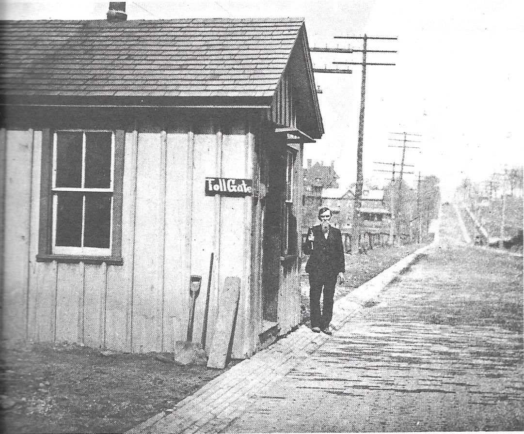
Searights Tollhouse
Next, we visited another National Road tollhouse, the Searights Tollhouse. Its design is very similar to the Addison Tollhouse that we saw on our last drive, but this one is built of brick instead of stone. The tollhouse was built near the tavern of William Searights, who just happened to be the state commissioner in charge of the roadway. Searights earned $730 a year for his job as commissioner. Between that and operating a tavern conveniently located to the tollhouse, he became one of the wealthiest men in Fayette County in the 1830s. Addison and Searights are the only remaining of the original six tollhouses along the Pennsylvania section of the National Road. The Searights Tollhouse now operates as a museum, open Tue-Sat 10-4 and Sun 2-6, mid-May through mid-October.
Left: The Searights Tavern, early 20th century. Right: Searights Tollhouse
Thanks to the rates still posted on the tollhouse, we know what this guy would have paid to transport his sheep: six cents for every 20 sheep.
The National Road in Uniontown
Our next stop was the Fayette County seat, Uniontown. At the Historic National Road Headquarters in Uniontown, we learned more about commerce along the National Road. Many stage companies competed for the fastest times between cities, and the ride wasn’t comfortable for any passengers. The road was rough, muddy and poorly graded in many places. In spite of the rough road, stage coaches sometimes covered as many as sixty-five miles in a day, changing horses about every fifteen miles in the mountains. Drivers earned about $12 a month plus room and board at inns contracted to their stage line.
In those early days of our national postal service, the government often contracted with private coach operators to deliver mail over long distances. In 1836, L. W. Stockton’s National Stage Company got a four-year contract. The contract was worth $63,000 per year, a huge sum on money at that time, but only on the condition that he could carry the mail from Wheeling at a speed of four miles per hour or faster.
A Little Uniontown History
This was our first stop in Uniontown in many years, so we had a lot to explore and a lot to learn.
Founded on the historic date of July 4, 1776, Uniontown was originally named Beesontown, after its founder, Henry Beeson. Beeson purchased the land from the Six Nations in 1768 and built the town’s first log house at the approximate site of present-day Mount Vernon Towers apartment building. Beeson built a grist mill along Redstone Creek and started selling lots.
Gaddis House about 1930
Another early settler, Thomas Gaddis, built the area’s second log building in 1769. Gaddis served in the American Revolution and later took charge of defense for the Uniontown area. His home was also known as Fort Gaddis because it was a site for meetings and shelter in time of emergency.
Settlement increased after the end of the American Revolution, and the growing town soon boasted a cabinet maker, cobbler, blacksmith, tailor and doctor, as well as two small log churches: Baptist and Methodist.
National Road tollgate in Uniontown, about 1905
Uniontown blossomed with the coming of the National Road, and grew further when the railroad from Connellsville and Pittsburgh came through in 1860. But the real boom started when a seam of coking coal was discovered nearby in the 1860s. By 1906, 40,0000 Fayette County men worked the coal mines.
The H.C. Frick Company alone mined over 19 million ton of coal that year, and Uniontown was the home to more millionaires per capita than any other city in the United States.
Like so many other Pennsylvania towns, Uniontown declined along with the decline of coal and steel. Its 2010 population was 10,372, about half of its 1940 peak.
When Al and I started our stroll through Uniontown’s historic downtown, it seemed unimpressive at first. Just another dreary old industrial town long past its glory days, lined with unused streetcar tracks and rows of sad, grimy nineteenth-century buildings. But, if you are patient, Uniontown slowly opens your eyes, not just to its architectural gems, but to its heroes.
Coming soon: Uniontown’s hidden charms and heroes
Sources
New Meadow Run School; Mountain Pike; Farmington, PA: Bruderhof Foundation, Inc., 1990.